Home
Images
Vectors
Videos
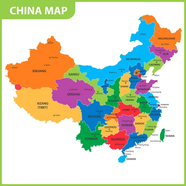
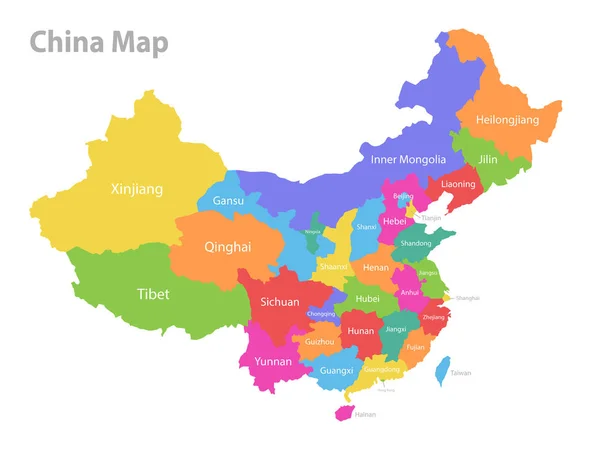
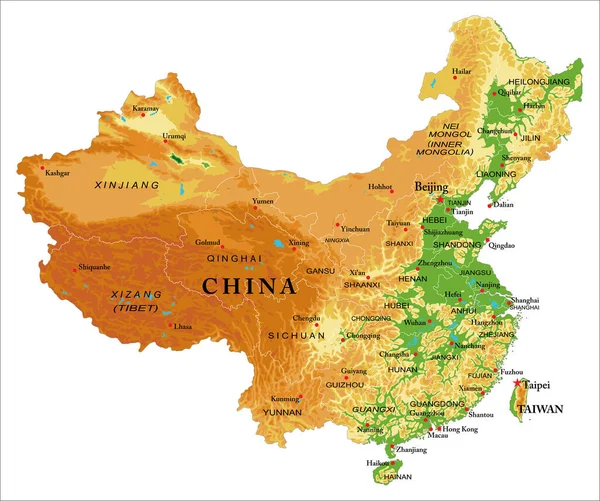
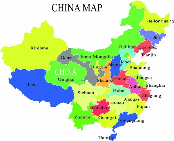
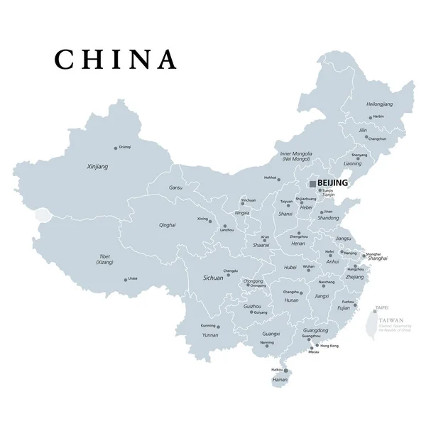
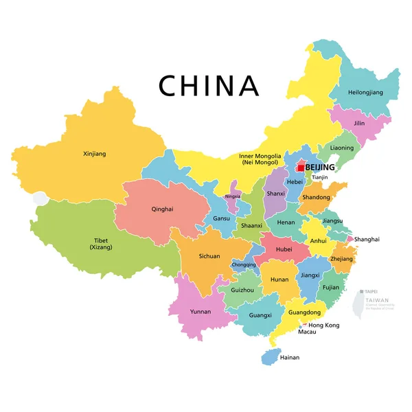
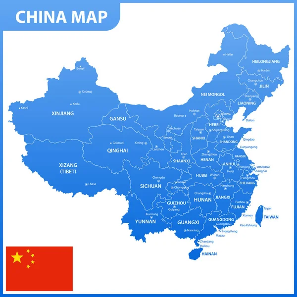
Stock vector China, political map with multicolored provinces. PRC, People's Republic of China with capital Beijing, borders and administrative divisions. English labeling. Isolated illustration over white. Vector
Published:
Mar.23, 2020 13:50:03
Author:
Furian
Views:
714
Downloads:
0
File type:
vector
/
eps
File size:
3.33 MB
Orginal size:
6000
x
6000
px
Available sizes:
S
(500 x 500)
M
(1000 x 1000)
L
(2000 x 2000)
XL
(6000 x 6000)
VECT
(6000 x 6000)
EL0
(6000 x 6000)
Level:
silver
Download Vector
Vector topics:
Color
Yellow
Vector
Illustration
Isolated
People
Border
Multicolor
Capital
East
China
Country
Map
Cartography
Geography
Continent
Land
Asia
State
Political
Administrative
Beijing
Republic
Shanghai
Region
Division
English
Territory
Administration
Atlas
Peoples
Mainland
Taiwan
Province
Hong
Nation
Macao
Tibet
Mapping
Kong
Macau
Prc
Hubei
White Background
Hong Kong
East Asia
Political Map
Hupeh
Similar stock vectors
China Political Map Isolated On White
8192 × 8091
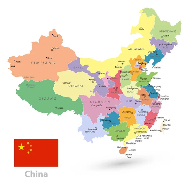
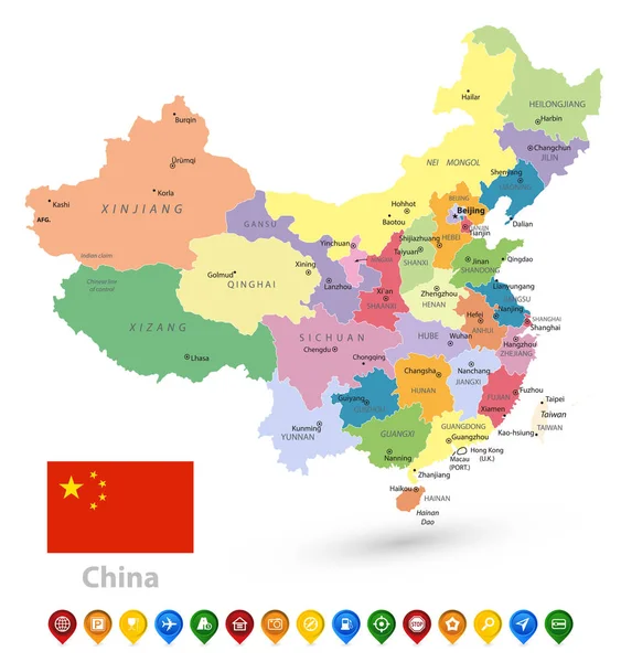
The Detailed Map Of The China With Regions Or States And Cities, Capitals, National Flag
5000 × 5000
The Detailed Map Of The China With Regions Or States And Cities, Capitals
7500 × 7500
China Map, Administrative Division, Separate Individual Region With Names, Color Map Isolated On White Background Vector
5048 × 3800
China Highly Detailed Physical Map,in Vector Format,with All The Relief Forms,regions And Big Cities.
5000 × 4180
China Map Vector Illustration
3208 × 2594
China, Gray Political Map, With Administrative Divisions. PRC, People's Republic Of China With Capital Beijing, Provinces With Capitals And Borders. English Labeling. Illustration Over White. Vector.
6000 × 6000
China Political Map Isolated On White And Map Pointers
7689 × 8192