Home
Images
Vectors
Videos
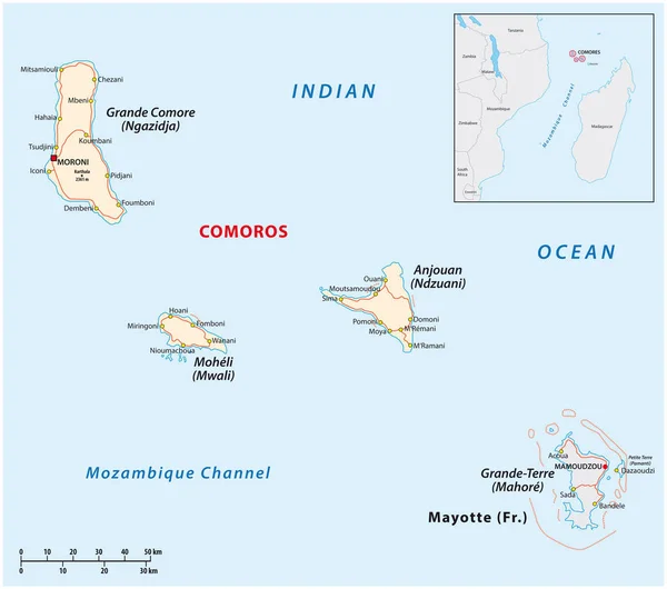
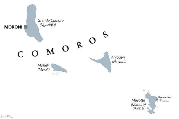
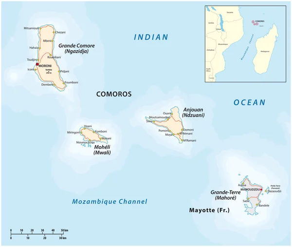
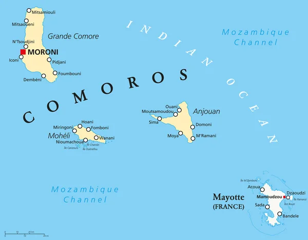
Stock vector Comoros and Mayotte Political Map
Published:
Dec.02, 2014 12:05:37
Author:
Furian
Views:
672
Downloads:
6
File type:
vector
/
eps
File size:
0.86 MB
Orginal size:
7694
x
6000
px
Available sizes:
S
(500 x 390)
M
(1000 x 780)
L
(2000 x 1560)
XL
(7694 x 6000)
VECT
(7694 x 6000)
EL0
(7694 x 6000)
Level:
silver
Download Vector
Vector topics:
Illustration
Travel
Abstract
France
Coastline
Country
Map
Cartography
Geography
Africa
Island
Union
Atlas
Reefs
Comoros
Archipelago
Moroni
Mayotte
Indian Ocean
Anjouan
Nzwani
Ngazidja
Grande Comore
Moheli
Mwali
Political Map
Mozambique Channel
Maore
Pamanzi
Oversea Department
Fomboni
Similar stock vectors
Map Of The Union Of The Comoros And Mayotte
3509 × 3100
Comoros And Mayotte Political Map
9777 × 6518
Map Of The Union Of The Comoros And Mayotte
3665 × 3100
Map Of The Union Of The Comoros And Mayotte
4000 × 3869
Illustrated Country Shape Of Comoros
4167 × 2778
Illustrated Country Shape Of Comoros
4167 × 2778
Comoro Islands Map And Names City, White Blue Card Paper 3D Vector
4875 × 3800