Home
Images
Vectors
Videos
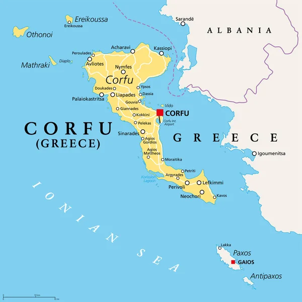
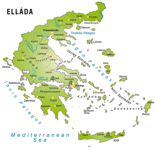
Stock vector Corfu, island of Greece, gray political map. Also Kerkyra, is a Greek island in the Ionian Sea, and part of the Ionian Islands. With Othonoi, Ereikoussa and Mathraki it forms the Corfu Regional Unit.
Published:
Jun.03, 2022 07:13:28
Author:
Furian
Views:
203
Downloads:
2
File type:
vector
/
eps
File size:
2.73 MB
Orginal size:
6000
x
6000
px
Available sizes:
S
(500 x 500)
M
(1000 x 1000)
L
(2000 x 2000)
XL
(6000 x 6000)
VECT
(6000 x 6000)
EL0
(6000 x 6000)
Level:
silver
Download Vector
Vector topics:
Vector
Illustration
Travel
Sea
Gray
Capital
Europe
Cruise
Country
Map
Cartography
Geography
Land
Mediterranean
Greek
Unit
Greece
Island
Political
Destination
Islands
Ionian
Atlas
Mapping
Regional
Albania
Corfu
Kerkyra
Korfu
Paxos
Vido
Mediterranean Sea
Greek Islands
Ionian Islands
Greek Island
Ionian Sea
Palaiokastritsa
Gaios
Political Map
Liapades
Acharavi
Antipaxos
Sinarades
Corfu Map
Ereikoussa
Lefkimmi
Othonoi
Regional Unit
Mathraki
Avliotes
Similar stock vectors
Corfu, Island Of Greece, Political Map. Also Known As Kerkyra, A Greek Island In The Ionian Sea And Part Of The Ionian Islands. With Othonoi, Ereikoussa And Mathraki It Forms The Corfu Regional Unit.
6000 × 6000
Ionian Islands Region Of Greece, Gray Political Map. Greek Island Group In The Ionian Sea. Corfu (Kerkyra), Paxos And Antipaxos, Lefkada, Kefalonia (Cephalonia), Ithaca (Ithaki) And Zakynthos (Zante).
6000 × 6000
Map Of The Aegean Sea, Part Of The Mediterranean Between Greece And Turkey
2337 × 2544
Map Of Greece
4151 × 3969
Map Of Greece
4151 × 3969
Republic Of Cyprus - Vector Map
4773 × 3714
Map Of The Cyprus In The Colors Of The Flag With Administrative Divisions Vector
5267 × 4000
Dodecanese Islands, Gray Political Map. Greek Island Group In The Southeastern Aegean Sea And Eastern Mediterranean Off The Coast Of Turkey. Rhodes Is The Most Dominant Island Since Antiquity. Vector
6000 × 7226