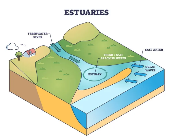
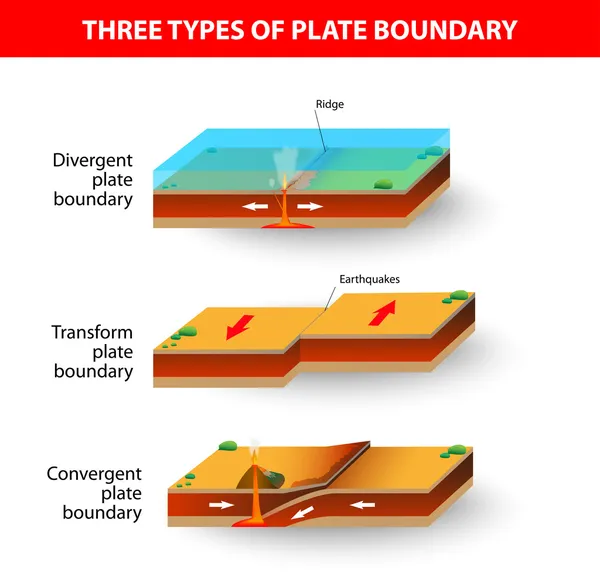
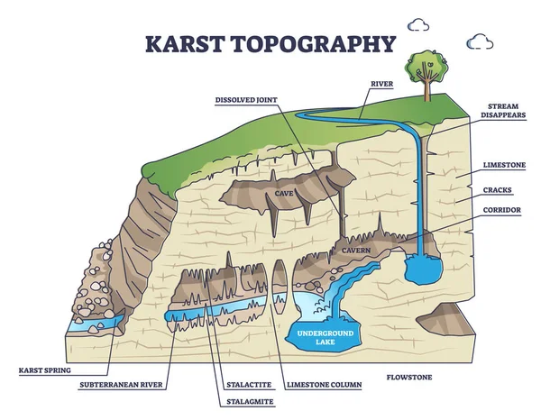
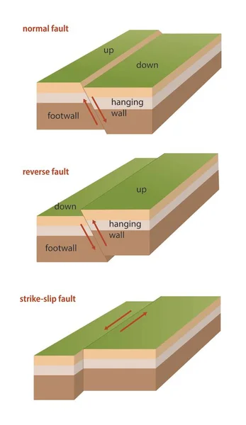
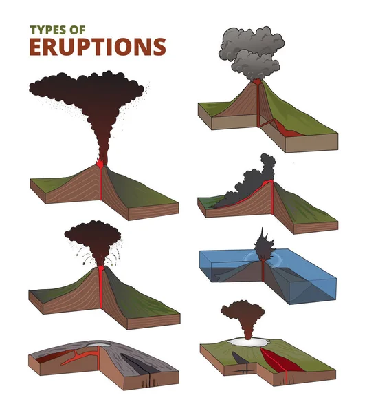
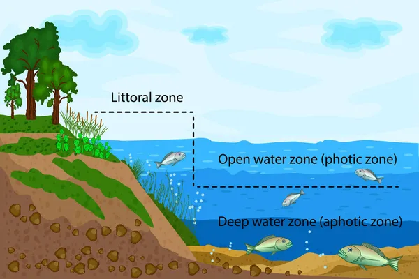
Stock vector Depositional landforms and sediment created relief area types outline diagram. Labeled educational scheme with gulf, peninsula, delta, bay and island water geological formation vector illustration.

Published: Jul.28, 2022 04:24:52
Author: VectorMine
Views: 39
Downloads: 1
File type: vector / eps
File size: 5.59 MB
Orginal size: 4500 x 3938 px
Available sizes:
Level: silver