Home
Images
Vectors
Videos
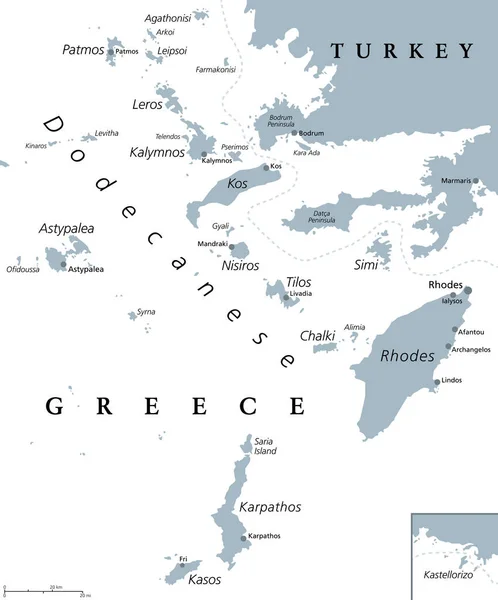
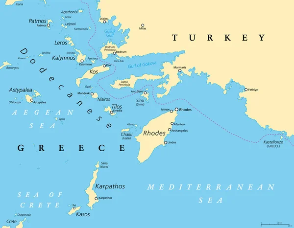
Stock vector Dodecanese, political map. Group of Greek islands in the southeastern Aegean Sea and Eastern Mediterranean, off the coast of Turkey. Rhodes is the dominant island since antiquity. Illustration. Vector
Published:
Apr.21, 2021 12:30:16
Author:
Furian
Views:
129
Downloads:
3
File type:
vector
/
eps
File size:
4.68 MB
Orginal size:
7722
x
6000
px
Available sizes:
S
(500 x 389)
M
(1000 x 777)
L
(2000 x 1554)
XL
(7722 x 6000)
VECT
(7722 x 6000)
EL0
(7722 x 6000)
Level:
silver
Download Vector
Vector topics:
Group
Vector
Illustration
Travel
Sea
Europe
Eastern
Country
Map
Cartography
Geography
Mediterranean
Turkey
Greek
Greece
Island
Political
Destination
Anatolia
Islands
Atlas
Crete
Aegean
Mapping
Rhodes
Bodrum
Dodecanese
Simi
Symi
Kos
Sporades
Patmos
Astypalea
Halki
Nisyros
Kalymnos
Mediterranean Sea
Aegean Sea
Astypalaia
Karpathos
Dodekanes
Tilos
Chalki
Leros
Kastellorizo
Nisiros
Kasos
Agathonisi
Leipsoi
Dodecanese Map
Similar stock vectors
Dodecanese Islands, Gray Political Map. Greek Island Group In The Southeastern Aegean Sea And Eastern Mediterranean Off The Coast Of Turkey. Rhodes Is The Most Dominant Island Since Antiquity. Vector
6000 × 7226
Greece Physiography Map
4864 × 5960
Map Of The Aegean Sea, Part Of The Mediterranean Between Greece And Turkey
2337 × 2544
Ionian Islands Region Of Greece, Gray Political Map. Greek Island Group In The Ionian Sea. Corfu (Kerkyra), Paxos And Antipaxos, Lefkada, Kefalonia (Cephalonia), Ithaca (Ithaki) And Zakynthos (Zante).
6000 × 6000
Ionian Islands Region Of Greece, Political Map. Greek Group Of Islands In The Ionian Sea. Corfu (Kerkyra), Paxos And Antipaxos, Lefkada, Kefalonia (Cephalonia), Ithaca (Ithaki), And Zakynthos (Zante).
6000 × 6000
Map Of The Aegean Sea, Part Of The Mediterranean Sea Between Greece And Turkey
3950 × 4000
Blue-gray Detailed Map Of Greece Administrative Divisions And Location On The Globe. Vector Illustration
5193 × 6402
Greece Map - Vintage Vector Illustration
5500 × 6001