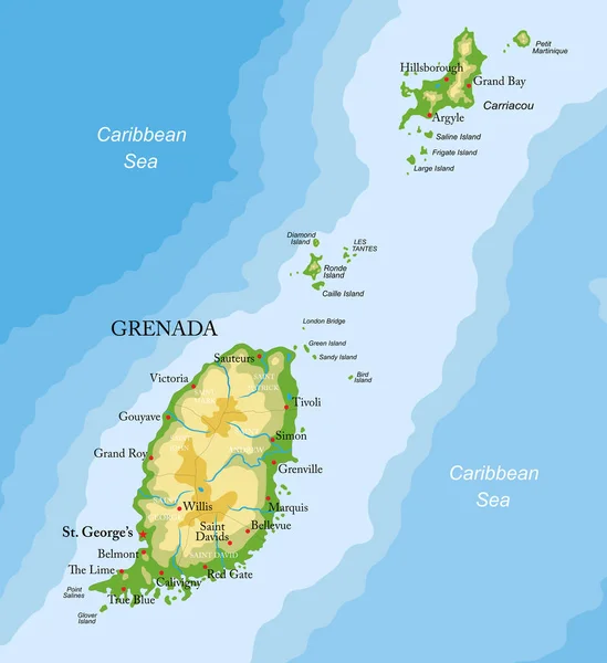
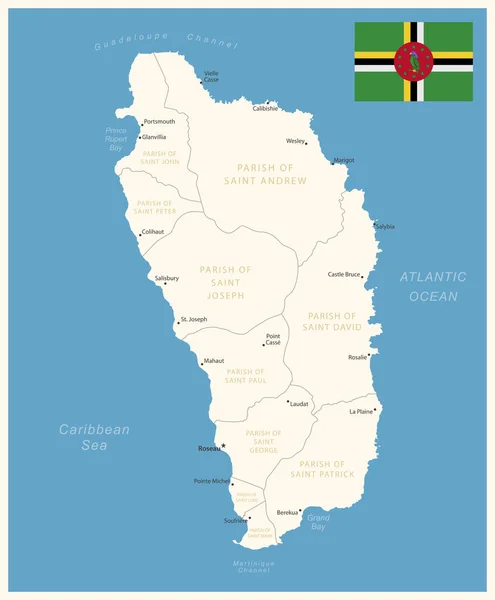
Stock vector Dominica - detailed map with administrative divisions and country flag. Vector illustration
Published: Jul.28, 2023 08:32:18
Author: gt29
Views: 1
Downloads: 0
File type: vector / eps
File size: 1.09 MB
Orginal size: 6033 x 7314 px
Available sizes:
Level: bronze