Home
Images
Vectors
Videos
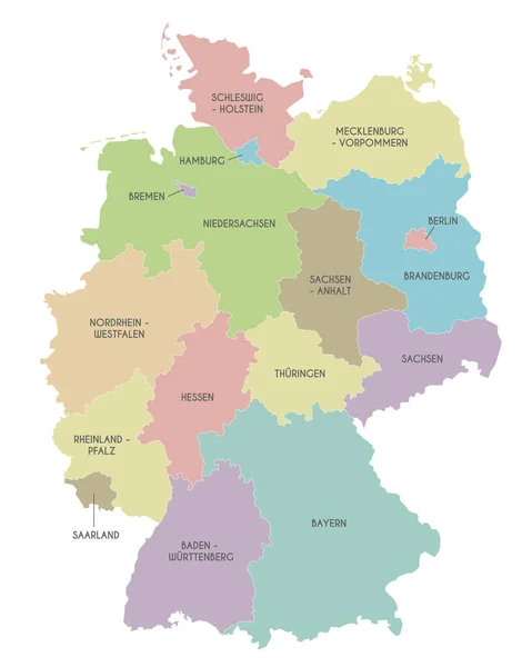
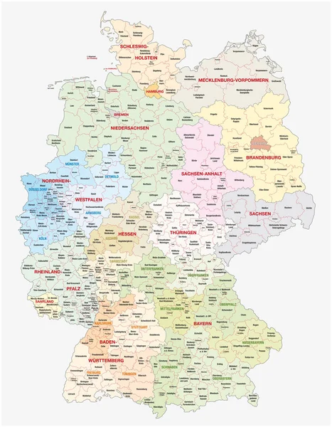
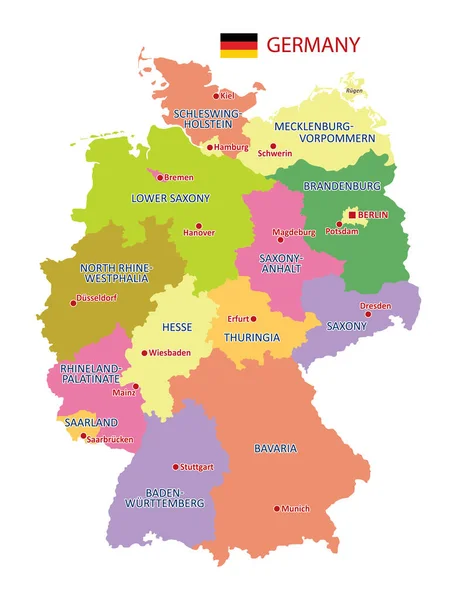
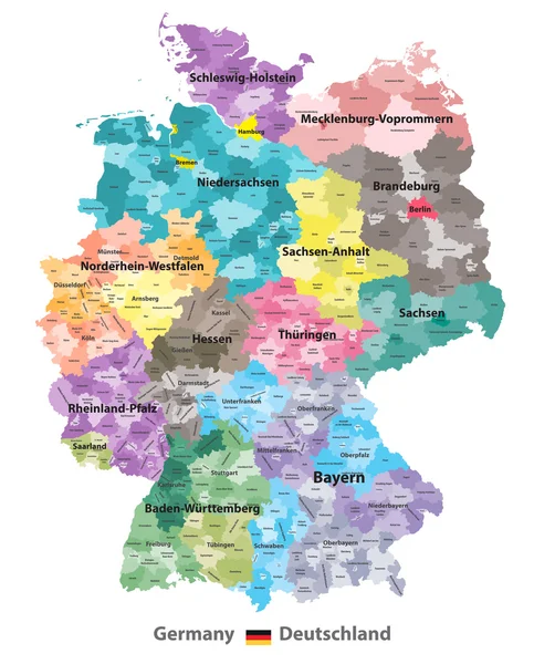
Stock vector Germany map (colored by states and administrative districts) with subdivisions
Published:
Sep.28, 2016 10:22:52
Author:
Jktu_21
Views:
1303
Downloads:
14
File type:
vector
/
eps
File size:
10.61 MB
Orginal size:
5788
x
7188
px
Available sizes:
S
(403 x 500)
M
(805 x 1000)
L
(1610 x 2000)
XL
(5788 x 7188)
VECT
(5788 x 7188)
EL0
(5788 x 7188)
Level:
silver
Download Vector
Vector topics:
Set
Isolated
Travel
European
Flag
Symbol
Icon
Buttons
Navigation
Country
Map
Geography
National
Germany
Land
Location
Berlin
Deutschland
Region
Division
Bavaria
Subdivision
Bayern
Brandenburg
Bremen
Hamburg
Hesse
Saxony
Thuringia
Nordrhein Westfalen
Schleswig Holstein
Saxony Anhalt
Oberbayern
Rhineland Palatinate
Schwaben
Darmstadt
Oberpfalz
National Flag
Germany Flag
Lower Saxony
Location Icon
Navigation Buttons
Germany Map
Regional Map
North Rhine Westphalia
Baden Wuttenberg
Vorpommen
Similar stock vectors
Germany High Detailed Vector Map (colored By States And Administrative Districts) With Subdivisions. All Layers Detachable And Labeled.
5801 × 7292
Germany States And Districts Colored Vector Map
6170 × 7293
Vector Map Of Germany With Federated States Or Regions And Administrative Divisions. Editable And Clearly Labeled Layers.
4000 × 5000
Illustrated Map Of Germany With Labels. Isolated Vector, Hand Drawn Style. Blue Color
6001 × 7647
Administrative And Political Vector Map Of Germany, Newly Revised 2019
6258 × 8029
Vector Map Of Germany With Detailed Administrative Divisions And Borders, City And Region Names And International Bordering Countries In Bright Colors Palette
3543 × 4653
Germany - Highly Detailed Map
4508 × 5001