Home
Images
Vectors
Videos
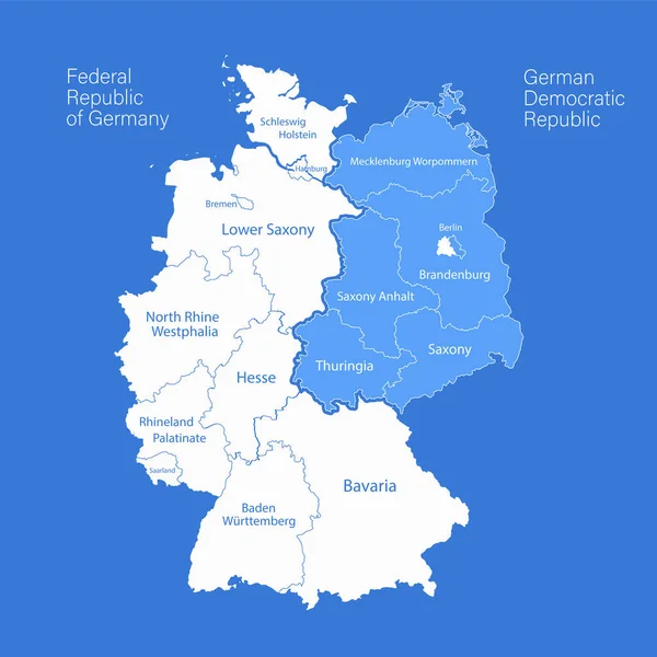
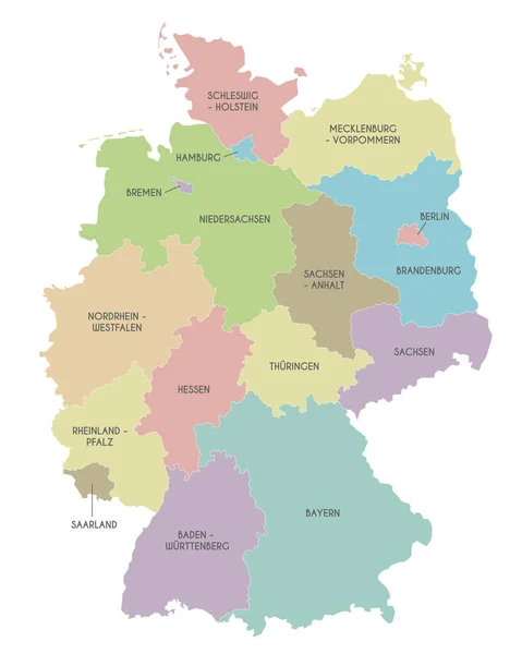
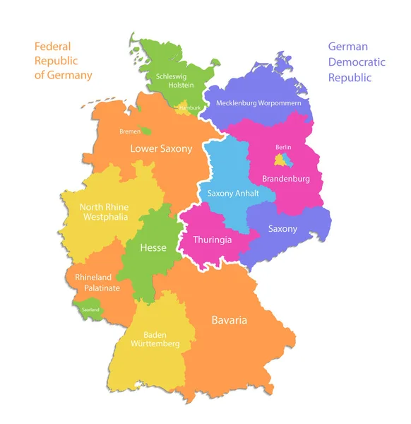
Stock vector Germany map divided on West and East map, administrative division, separate regions with names, color map isolated on white background vector
Published:
Feb.02, 2022 19:07:52
Author:
Mondi.h
Views:
211
Downloads:
0
File type:
vector
/
eps
File size:
1.24 MB
Orginal size:
4075
x
4200
px
Available sizes:
S
(485 x 500)
M
(970 x 1000)
L
(1940 x 2000)
XL
(4075 x 4200)
VECT
(4075 x 4200)
EL0
(4075 x 4200)
Level:
bronze
Download Vector
Vector topics:
Green
Color
Colors
Blue
Vector
Background
Colorful
Graphic
Illustration
Design
Isolated
Travel
European
Silhouette
Concept
City
Contour
Earth
World
Tourism
Capital
Europe
Individual
Outline
Country
Map
Cartography
Geography
National
Continent
State
Separate
Political
Berlin
Region
Atlas
Mapping
Names
Hamburg
Regions
White Background
Isolated On White
East Germany
West Germany
Federal Republic Of Germany
German Democratic Republic
Germany Map
Wall Map
Administrative Division
Individual Regions
Similar stock vectors
Germany Map Divided On West And East Map, Administrative Divisions Whit Names Regions, Blue Background Vector
4000 × 4000
Vector Map Of Germany With Detailed Administrative Divisions And Borders, City And Region Names And International Bordering Countries In Bright Colors Palette
3543 × 4653
Germany States And Districts Colored Vector Map
6170 × 7293
Germany Map
6907 × 7502
Germany Map Icon, Geography Blank Concept, Isolated Graphic Background Vector Illustration .
4096 × 4096
Vector Illustration Of Administrative Division Map Of Germany. Vector Map.
4500 × 4500
Vector Map Of Germany With Federated States Or Regions And Administrative Divisions. Editable And Clearly Labeled Layers.
4000 × 5000