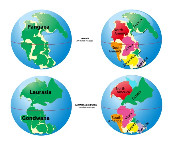
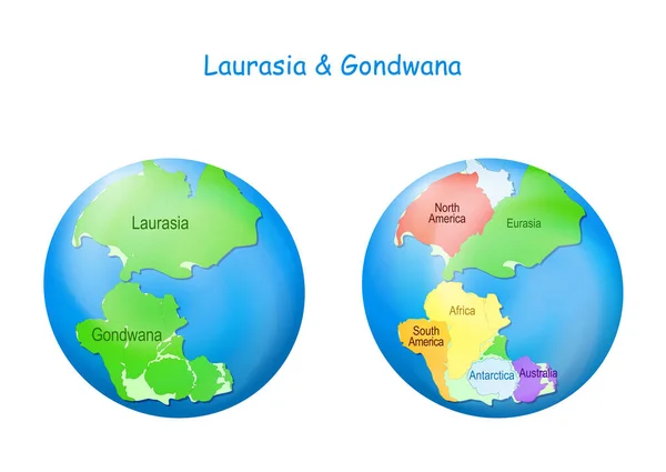
Stock vector globe with Laurasia and Gondwana, continental borders, and ocean Tethys. Gondwana and Laurasia formed the Pangaea supercontinent. Maps. Continental drift theory. planet Earth millions years ago. vector illustration for education
Published: Dec.24, 2020 10:57:20
Author: edesignua
Views: 308
Downloads: 7
File type: vector / eps
File size: 9.21 MB
Orginal size: 5000 x 3547 px
Available sizes:
Level: silver