Home
Images
Vectors
Videos
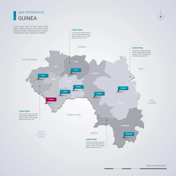
Stock vector Guinea higt detailed map with subdivisions. Administrative map of Guinea with districts and cities name, colored by states and administrative districts. Vector illustration with editable and labelled layers.
Published:
Nov.02, 2020 08:55:10
Author:
molokowall
Views:
4
Downloads:
0
File type:
vector
/
eps
File size:
1.15 MB
Orginal size:
4000
x
4000
px
Available sizes:
S
(500 x 500)
M
(1000 x 1000)
L
(2000 x 2000)
XL
(4000 x 4000)
VECT
(4000 x 4000)
EL0
(4000 x 4000)
Level:
bronze
Download Vector
Vector topics:
Color
Vector
Travel
Border
City
Template
Capital
Country
District
Map
Cartography
Geography
State
Layer
Separate
Location
Administrative
Destination
Region
Editable
Subdivision
Boke
GUINEA
Labe
Conakry
Kankan
Faranah
Mamou
Kindia
Nzerekore
Similar stock vectors
Isometric 3D Guinea Map. Stylized Vector Map Illustration With Cities, Borders, Capital, Administrative Divisions And Pointer Marks; Gradient Background With Grid.
4000 × 3000
Guinea Vector Map With Infographic Elements, Pointer Marks. Editable Template With Regions, Cities And Capital Conakry.
4000 × 4000
Georgia Higt Detailed Map With Subdivisions. Administrative Map Of Georgia With Districts And Cities Name, Colored By States And Administrative Districts. Vector Illustration.
5000 × 4000
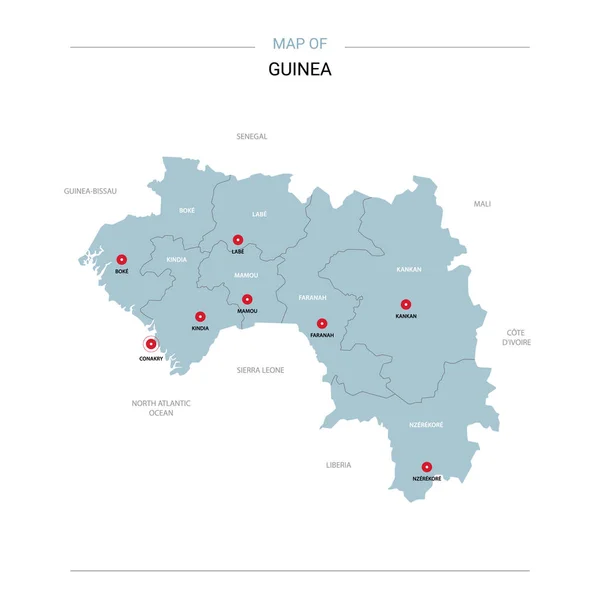
Guinea Vector Map. Editable Template With Regions, Cities, Red Pins And Blue Surface On White Background.
3000 × 3000
Guinea Poster In Retro Style. Map Of The Country With Regions In Autumn Color Palette. Shape Of Guinea With Country Name. Vibrant Vector Illustration.
5729 × 5274
Guinea Map Country Poster With Regions Old Grunge Texture Shape Of Guinea With Country Name
5732 × 5268
Kazakhstan Higt Detailed Map With Subdivisions. Administrative Map Of Kazakhstan With Districts And Cities Name, Colored By States And Administrative Districts. Vector Illustration.
5000 × 4000
Sierra Leone Higt Detailed Map With Subdivisions. Administrative Map Of Sierra Leone With Districts And Cities Name, Colored By States And Administrative Districts. Vector Illustration With Editable And Labelled Layers.
4000 × 4000