Home
Images
Vectors
Videos
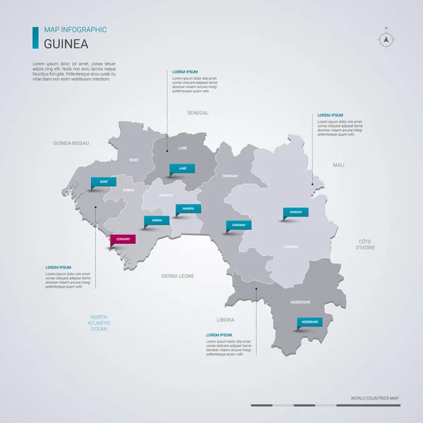
Stock vector Guinea vector map with infographic elements, pointer marks. Editable template with regions, cities and capital Conakry.
Published:
Jan.30, 2019 12:23:25
Author:
molokowall
Views:
43
Downloads:
1
File type:
vector
/
eps
File size:
2.12 MB
Orginal size:
4000
x
4000
px
Available sizes:
S
(500 x 500)
M
(1000 x 1000)
L
(2000 x 2000)
XL
(4000 x 4000)
VECT
(4000 x 4000)
EL0
(4000 x 4000)
Level:
bronze
Download Vector
Vector topics:
Red
White
Blue
Vector
Background
Isolated
Travel
Border
Symbol
City
Contour
Information
Pin
Education
World
Template
Town
Globe
Identity
Point
Outline
Country
District
Map
Cartography
Geography
Continent
Land
Ground
State
Topography
Location
Political
Politics
Geographic
Region
Editable
Territory
Atlas
Nation
Subdivision
Mapping
GUINEA
Infographic
Travel Map
Vector Map
Guinea Map
Similar stock vectors
Guinea Map With Borders, Cities, Capital And Administrative Divisions. Infographic Vector Map. Editable Layers Clearly Labeled.
3000 × 3000
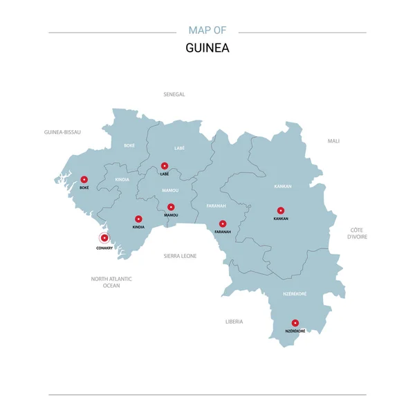
Guinea Vector Map. Editable Template With Regions, Cities, Red Pins And Blue Surface On White Background.
3000 × 3000
Guinea Vector Map Infographic Template. Slide Presentation. Global Business Marketing Concept. Color Country. World Transportation Geography Data.
6667 × 3751
Guinea Map With Location Pointer Marks. Infographic Vector Template, Isolated On White Background.
4000 × 4000
Equatorial Guinea Vector Map With Infographic Elements, Pointer
4000 × 4000
Isometric 3D Guinea Map. Stylized Vector Map Illustration With Cities, Borders, Capital, Administrative Divisions And Pointer Marks; Gradient Background With Grid.
4000 × 3000
Guinea Higt Detailed Map With Subdivisions. Administrative Map Of Guinea With Districts And Cities Name, Colored By States And Administrative Districts. Vector Illustration With Editable And Labelled Layers.
4000 × 4000
Equatorial Guinea Map With Borders, Cities, Capital And Administrative Divisions. Infographic Vector Map. Editable Layers Clearly Labeled.
3000 × 3000