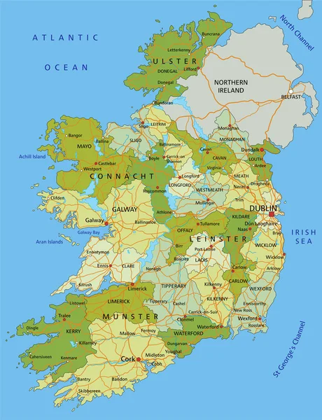
Stock vector Highly detailed editable political map with separated layers. Ireland.
Published: Feb.02, 2022 09:16:53
Author: delpieroo
Views: 12
Downloads: 2
File type: vector / eps
File size: 6.82 MB
Orginal size: 4353 x 5672 px
Available sizes:
Level: bronze
Similar stock vectors
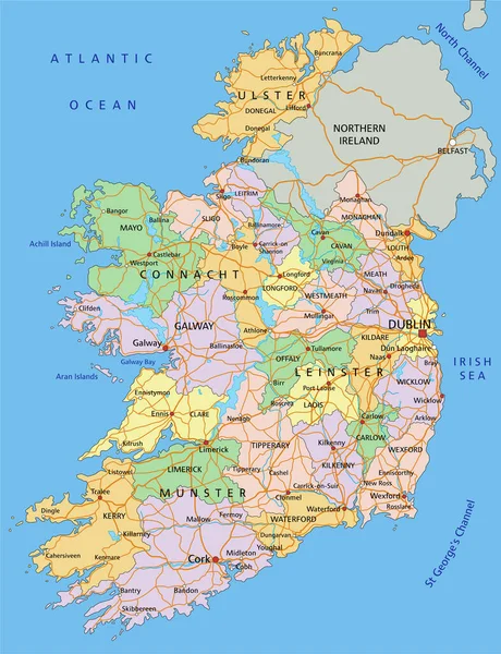
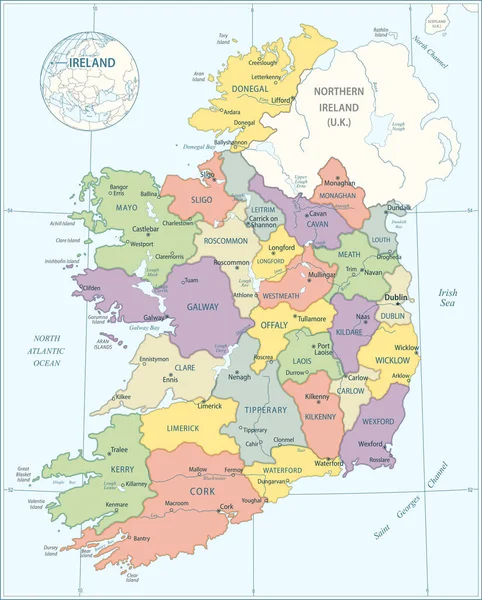
Colorful Ireland Political Map With Clearly Labeled, Separated Layers. Vector Illustration.
4353 × 5672