Home
Images
Vectors
Videos
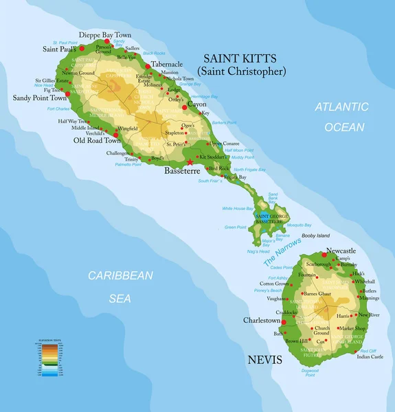
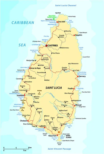
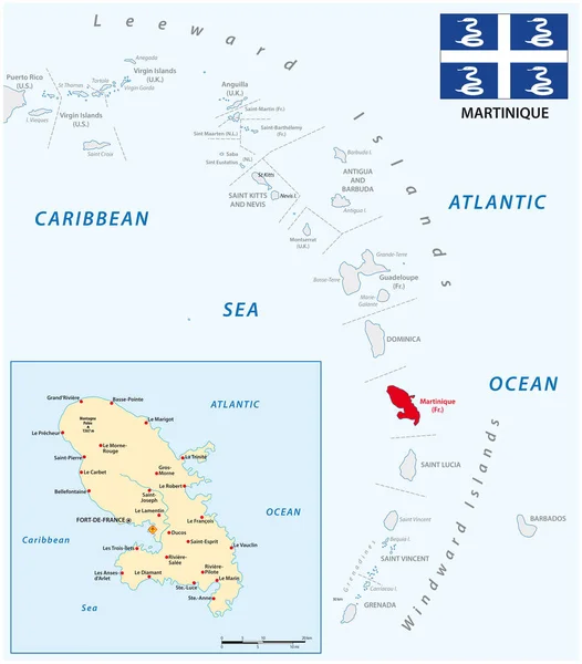
Stock vector Highly detailed vector map of Saint Kitts and Nevis with administrative regions, main cities and roads.
Published:
Jun.30, 2020 08:35:48
Author:
BogdanSerban
Views:
6
Downloads:
0
File type:
vector
/
eps
File size:
2.99 MB
Orginal size:
4801
x
5000
px
Available sizes:
S
(480 x 500)
M
(960 x 1000)
L
(1920 x 2000)
XL
(4801 x 5000)
VECT
(4801 x 5000)
EL0
(4801 x 5000)
Level:
beginner
Download Vector
Vector topics:
Vector
Background
Illustration
Travel
Sun
Sea
Silhouette
Border
Road
City
Beach
Ocean
Outline
Country
Map
Cartography
Geography
Continent
Island
Atlantic
Destination
Caribbean
Eps
Nevis
Basseterre
Charlestown
Saint Kitts
Similar stock vectors
Road Vector Map Of Sint Marteen-Sint Maarten.
4136 × 3100
Highly Detailed Vector Map Of Grenada With Administrative Regions, Main Cities And Roads.
4861 × 5000
Map Of The Dutch Saba Bank National Park In The Caribbean Sea
3764 × 3100
Map Of The Antilles Island In The French Overseas Territories Of Saint-Barthelemy
4583 × 3100
Saint Kitts And Nevis Highly Detailed Physical Map
7195 × 7500
Road Vector Map Of The West Indian Island State Of Saint Lucia
3710 × 4000
Road Map Of Guadeloupe
7968 × 6992
Vector Map Of The Lesser Antilles With The Martinique Archipelago
3100 × 3532