Home
Images
Vectors
Videos
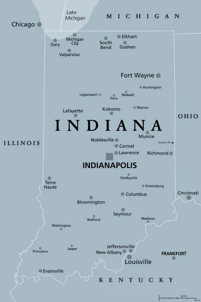
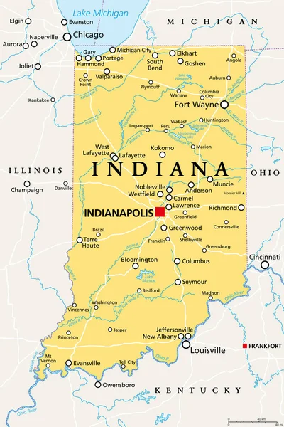
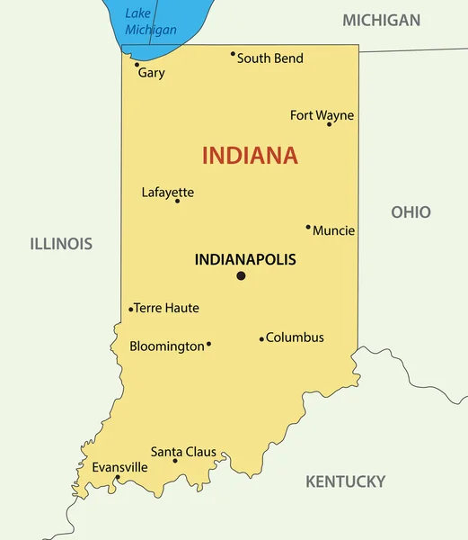
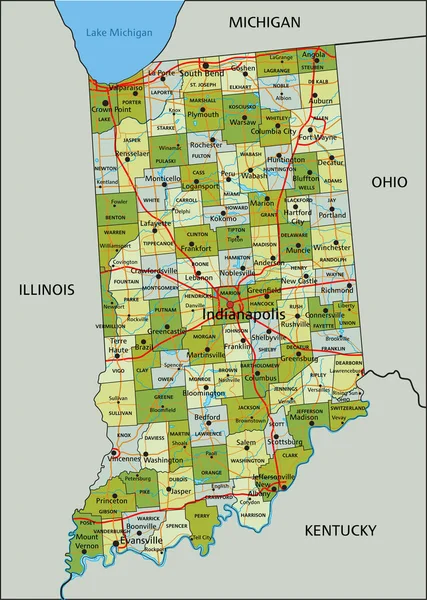
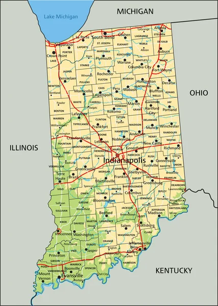
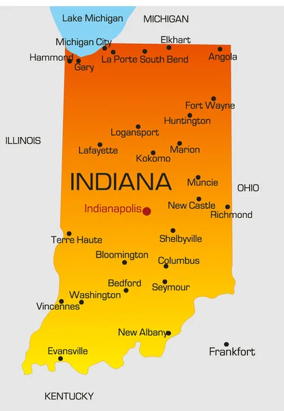
Stock vector Indiana
Published:
Mar.01, 2010 16:31:11
Author:
olinchuk
Views:
593
Downloads:
10
File type:
vector
/
eps
File size:
0.74 MB
Orginal size:
2549
x
3684
px
Available sizes:
S
(346 x 500)
M
(692 x 1000)
L
(1384 x 2000)
XL
(2549 x 3684)
VECT
(2549 x 3684)
EL0
(2549 x 3684)
Level:
gold
Download Vector
Vector topics:
Color
White
Blue
Vector
Round
Background
Circle
Graphic
Illustration
Shape
New
Travel
Abstract
Sea
Cut
Square
Symbol
Fingers
Digital
Drawing
World
American
Us
Usa
Ocean
North
South
Outline
Country
West
Map
Geography
National
Fill
State
America
Borders
Boundary
Of
United
Washington
York
Tennessee
Ladies
Mexico
Nation
Indiana
Dakota
Michigan
Illinois
Similar stock vectors
Indiana, IN, Gray Political Map With The Capital Indianapolis, And Most Important Cities, Rivers And Lakes. State In The Midwestern Region Of The United States Of America, Nicknamed The Hoosier State.
6000 × 9000
Indiana, IN, Political Map, With The Capital Indianapolis, And Most Important Cities, Rivers And Lakes. State In The Midwestern Region Of The United States Of America, Nicknamed The Hoosier State.
6000 × 9000
Indiana - Vector Map
4198 × 4825
Indiana Cities Map
3504 × 5004
Indiana - Highly Detailed Editable Political Map With Labeling.
3387 × 4760
Highly Detailed Editable Political Map With Separated Layers. Indiana.
3387 × 4760
High Detailed Indiana Physical Map With Labeling.
3387 × 4760
Road Trip To Indiana, Red, White And Blue Interstate Highway Road Sign With Word Indiana And Map Of Indiana With Sky Background
3456 × 3456