Home
Images
Vectors
Videos
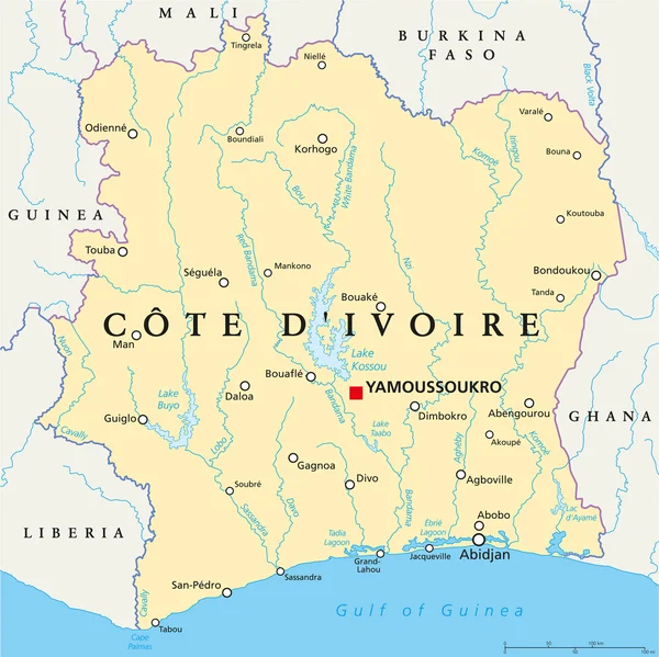
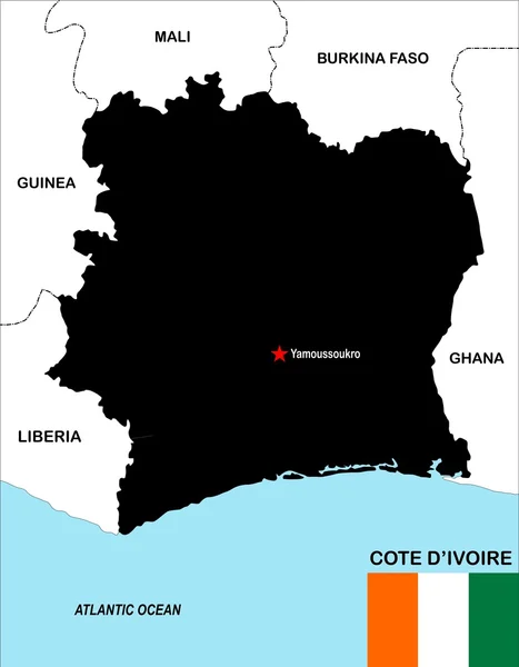
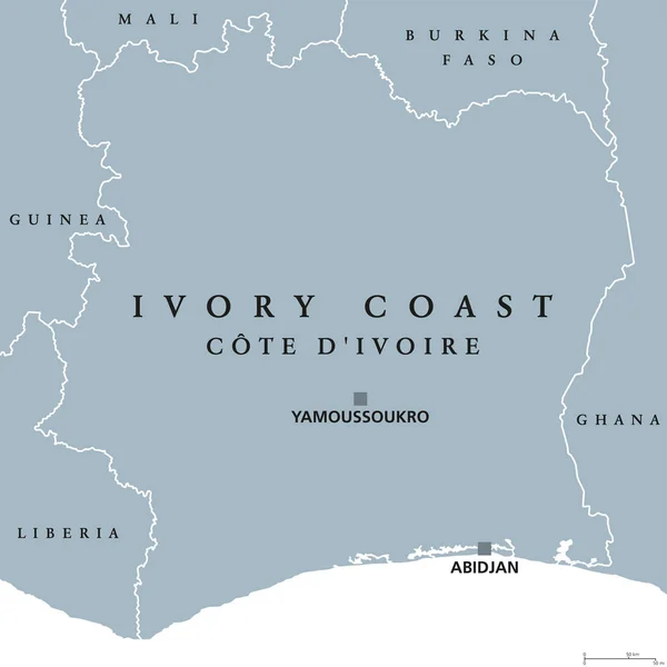
Stock vector Ivory Coast, Cte d'Ivoire, political map
Published:
Jul.17, 2017 09:55:22
Author:
Furian
Views:
37
Downloads:
0
File type:
vector
/
eps
File size:
3.02 MB
Orginal size:
8033
x
8033
px
Available sizes:
S
(500 x 500)
M
(1000 x 1000)
L
(2000 x 2000)
XL
(8033 x 8033)
VECT
(8033 x 8033)
EL0
(8033 x 8033)
Level:
silver
Download Vector
Vector topics:
Vector
Illustration
Isolated
Labeling
Travel
Gray
Coast
Ocean
Capital
Country
West
Map
Cartography
Geography
Africa
Land
Ivory
State
Atlantic
Republic
English
Atlas
Ghana
Nation
Cote
GUINEA
Mali
Liberia
Ivoire
Abidjan
Yamoussoukro
White Background
Burkina Faso
Cote DIvoire
Ivory Coast
West Africa
Political Map
Similar stock vectors
Ivory Coast Political Map - Cote D'Ivoire
6003 × 6000
Ivory Coast Hand-drawn Sketch Map
4188 × 3696
Republic Of Côte D'Ivoire - Vector Map
3706 × 3996
3D Map Of Ivory Coast With Country Name Highlighted Red On White
6000 × 6000
Cote D'ivoire Map
4123 × 5292
Cote DIvoire Information Map.
4724 × 4724
Verctor Map Of Cities And Roads In Cote DIvoire.
7087 × 7087
Map Of Ivory Coast With Capitals In Pastel Orange
3954 × 4319