Home
Images
Vectors
Videos
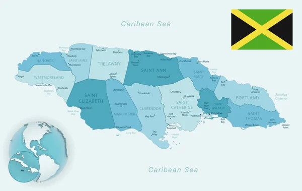
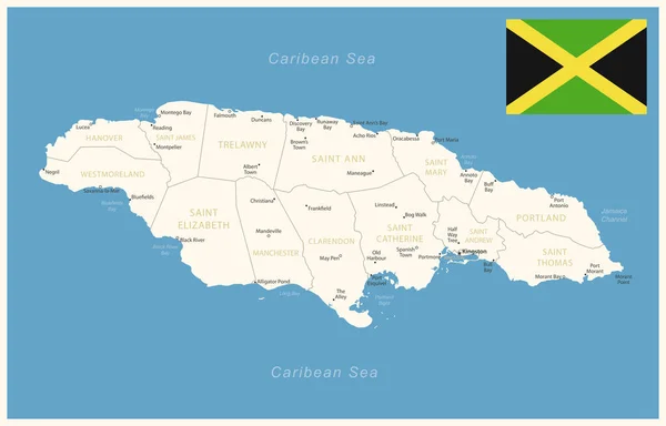
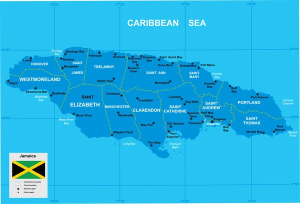
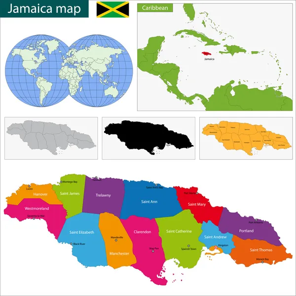
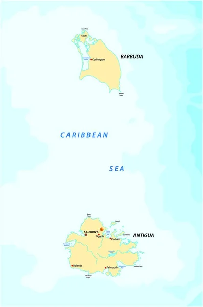
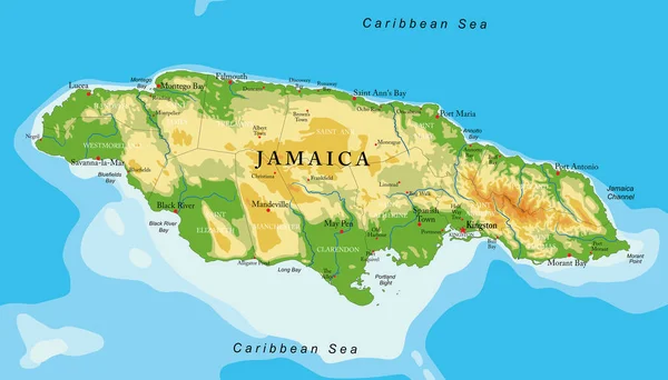
Stock vector Jamaica - detailed map of the country in brown colors, divided into regions. Vector illustration
Published:
Oct.01, 2024 15:28:49
Author:
gt29
Views:
0
Downloads:
0
File type:
vector
/
eps
File size:
0.91 MB
Orginal size:
7293
x
4673
px
Available sizes:
S
(500 x 320)
M
(1000 x 641)
L
(2000 x 1282)
XL
(7293 x 4673)
VECT
(7293 x 4673)
EL0
(7293 x 4673)
Level:
bronze
Download Vector
Vector topics:
Vector
Background
Business
Travel
Brown
Border
Retro
Vintage
Flag
Road
Earth
World
Tourism
Detailed
Highly
Layout
Country
Map
Cartography
Icons
Geography
Continent
Tourist
Separation
State
Political
Printed
Marker
Jamaica
Provinces
Territories
Kingston
Municipalities
Infographics
Infographic
North America
Dark Green
Jamaica Flag
Jamaica Map
Administrative Divisions
Tourist Signs
Individual Regions
Geographical Signs
Similar stock vectors
Blue-green Detailed Map Of Jamaica Administrative Divisions With Country Flag And Location On The Globe. Vector Illustration
8224 × 5200
Jamaica - Detailed Map With Administrative Divisions And Country Flag. Vector Illustration
9335 × 5976
Vector Map Of Jamaica
5631 × 3838
Map Of Jamaica
7000 × 7000
Caribbean Map With Flags And Location
6350 × 4245
Caribbean Islands Map, Island With Names, Card Paper 3D Natural Vector
5731 × 3800
Map Of The Caribbean Islands Antigua And Barbuda
2183 × 3296
Jamaica Highly Detailed Physical Map,in Vector Format,with All The Relief Forms,regions And Big Cities.
5500 × 3135