Home
Images
Vectors
Videos
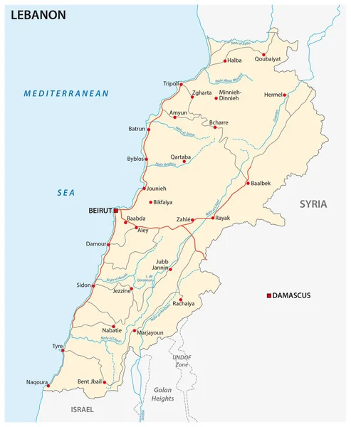
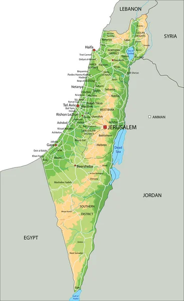
Stock vector Lebanon Political Map
Published:
Oct.15, 2015 15:59:01
Author:
Furian
Views:
932
Downloads:
16
File type:
vector
/
eps
File size:
1.14 MB
Orginal size:
6000
x
7396
px
Available sizes:
S
(406 x 500)
M
(811 x 1000)
L
(1622 x 2000)
XL
(6000 x 7396)
VECT
(6000 x 7396)
EL0
(6000 x 7396)
Level:
silver
Download Vector
Vector topics:
Illustration
Travel
Abstract
Coastline
Capital
Country
Map
Cartography
Geography
Africa
Land
State
Destination
Republic
Israel
Atlas
Golan
Syria
Lebanon
BEIRUT
Lebanese
Tripoli
Byblos
Middle East
Mediterranean Sea
Golan Heights
Lebanese Republic
Political Map
Sidon
Bekaa Valley
Litani River
Lebanon Political Map
Similar stock vectors
Political Map Of Israel With National Borders, Cities And Rivers
4000 × 6500
High Detailed Israel Physical Map With Labeling.
3461 × 5648
Highly Detailed Editable Political Map With Separated Layers. Israel.
3461 × 5648
Israel - Highly Detailed, Editable Political Map With Labeling.
3461 × 5648
Colorful Israel Political Map With Clearly Labeled, Separated Layers. Vector Illustration.
3461 × 5648
Roads Vector Map Of The Lebanese Republic With Flag
3100 × 3767
High Detailed Israel Physical Map With Labeling.
3461 × 5648