Home
Images
Vectors
Videos
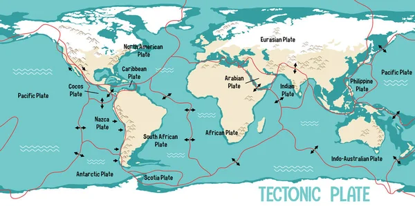
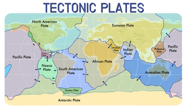
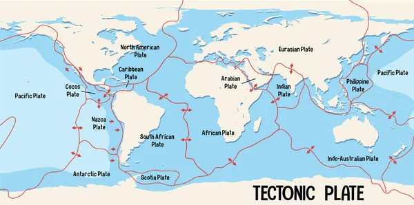
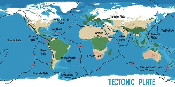
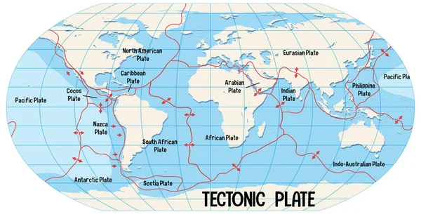
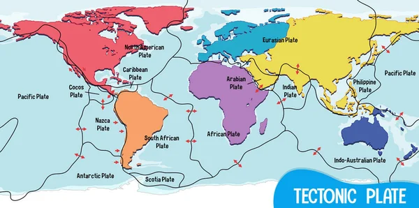
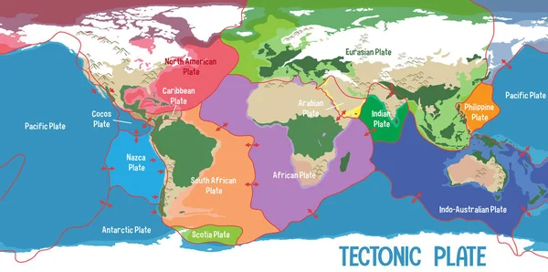
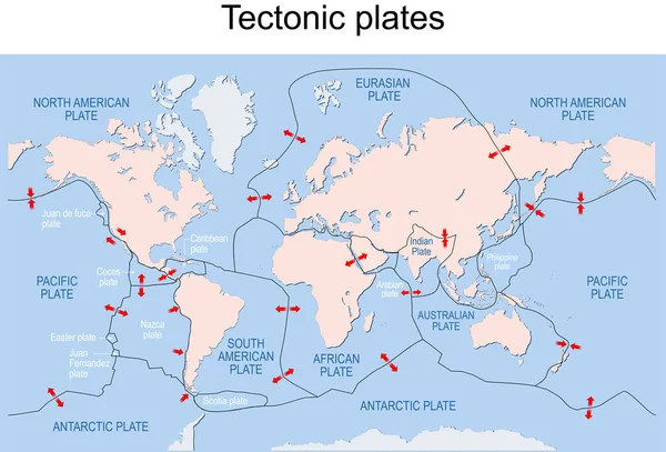
Stock vector Map of Earth's principal tectonic plates. Earth's lithosphere. Major and minor plates. arrows indicate direction of movement at plate boundaries. Vector illustration
Published:
Apr.04, 2022 10:01:09
Author:
edesignua
Views:
41
Downloads:
2
File type:
vector
/
eps
File size:
3.61 MB
Orginal size:
11775
x
7995
px
Available sizes:
S
(500 x 339)
M
(1000 x 679)
L
(2000 x 1358)
XL
(11775 x 7995)
VECT
(11775 x 7995)
EL0
(11775 x 7995)
Level:
silver
Download Vector
Vector topics:
Object
Illustration
Nature
Environment
Plate
Dish
Sea
Border
Cartoon
Motion
Global
Education
Earth
Planet
Movement
Ocean
Science
Globe
Direction
Map
Cartography
Arrows
Geography
Outside
Crust
Pacific
Land
Geology
Continental
Theory
Scientific
International
Antarctic
Plates
Indian
Boundaries
Mantle
Earthquake
Eps
Minor
Eurasian
Names
Major
Labeled
Seafloor
Tectonic
Lithosphere
Indo Australian
Similar stock vectors
World Map Showing Tectonic Plates Boundaries Illustration
6683 × 3325
Map Of Tectonic Plates And Boundaries Illustration
6337 × 3683
World Map Showing Tectonic Plates Boundaries Illustration
6683 × 3325
World Map Showing Tectonic Plates Boundaries Illustration
6683 × 3325
World Map Showing Tectonic Plates Boundaries Illustration
6599 × 3367
World Map Showing Tectonic Plates Boundaries Illustration
6683 × 3325
World Map Showing Tectonic Plates Boundaries Illustration
6683 × 3325
World Map Showing Tectonic Plates Boundaries Illustration
6599 × 3367