
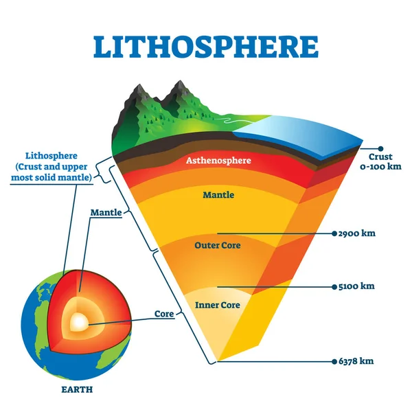
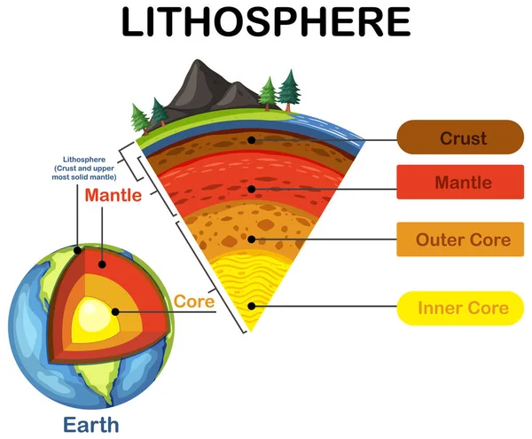
Stock image Lithosphere

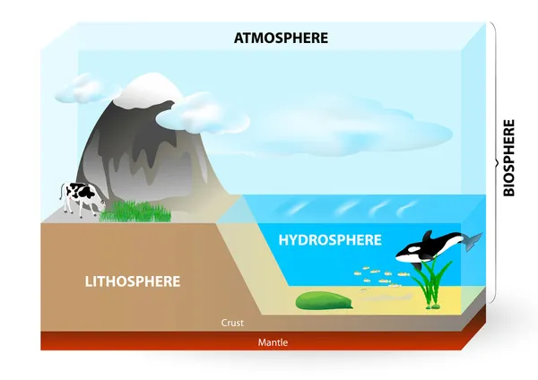
Biosphere Division With Labeled Ecosystem Explanation Scheme Outline Concept
Vector, 5.59MB, 4000 × 4000 eps
Lithosphere Vector Illustration. Labeled Educational Earth Outer Shell Scheme
Vector, 5.99MB, 4000 × 4000 eps

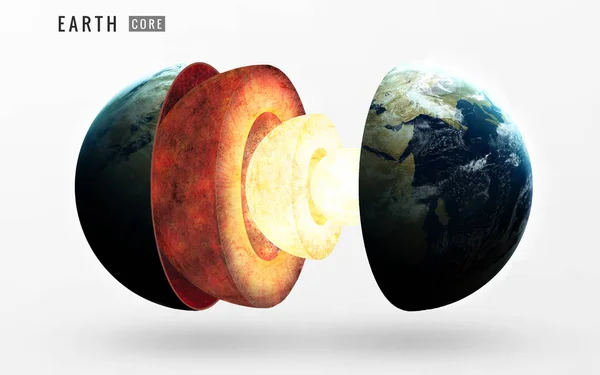
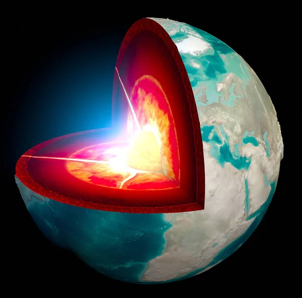
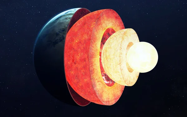
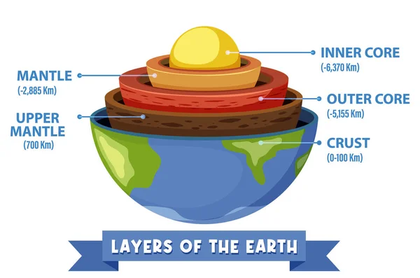
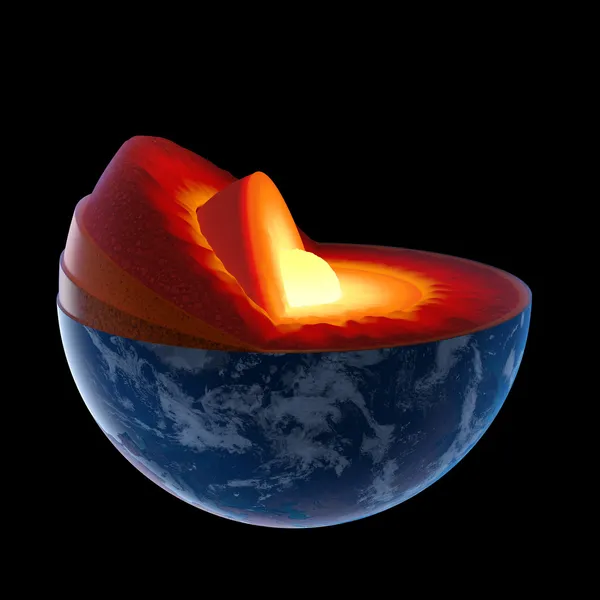
Structure Core Earth. Structure Layers Of The Earth. The Structure Of The Earths Crust. Earth Cross Section In Space View. Elements Of This Image Furnished By NASA. 3D Rendering.
Image, 10.2MB, 6000 × 4000 jpg
Earth Structure Isolated On White. Crust, Upper Mantle, Lower , Outer Core And Inner . Cutaway. Layered .
Image, 5.04MB, 5548 × 5504 jpg
Earth Structure Isolated On Black. Crust, Upper Mantle, Lower , Outer Core And Inner . Cutaway. Layered .
Image, 5.27MB, 5548 × 5504 jpg


Neighborhoods Of The Caribbean Tectonic Plate On The Grayscale Map In The Van Der Grinten I Projection (oblique Transformation). Raw Composite - No Outlines
Image, 2.65MB, 2880 × 1620 jpg


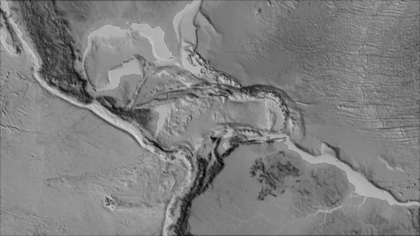
Relief Map Of The Area Around The Pacific Tectonic Plate. 3D Rendering
Image, 5.32MB, 2880 × 1620 jpg
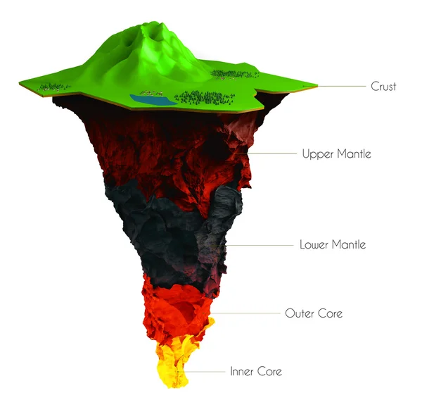
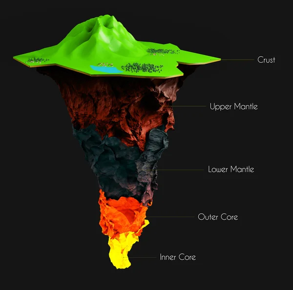
Section Of The Earth, Globe. Core And Soil Layers. Earth's Surface And Ground Section. 3d Rendering
Image, 8.72MB, 5420 × 5354 jpg
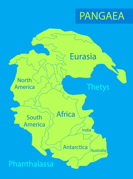
Pangaea Or Pangea. Vector Illustration Of Supercontinent That Existed During The Late Paleozoic And Early Mesozoic Eras. Map Of Green Ancient Continent And Ocean In Flat Style. Poster. Education
Vector, 4.63MB, 5000 × 6667 eps

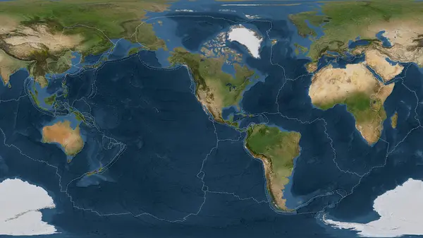
Tectonic Plates Move Constantly, Making New Areas Of Ocean Floor, Building Mountains, Causing Earthquakes, And Creating Volcanoes. 3d Rendering. Map. Element Of This Image Are Furnished By Nasa
Image, 9.22MB, 5014 × 5010 jpg

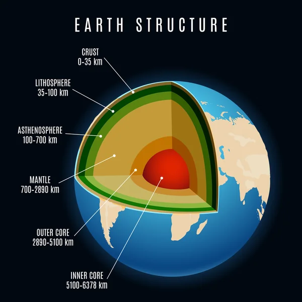
The Structure Of Earth In Cross Section, The Layers Of The Core, Mantle, Asthenosphere, Lithosphere, Mesosphere. Template Of Page Banner For Education, Vector Illustration.
Vector, 3.25MB, 6000 × 6000 eps

Vector Handdrawn Stylized Map Of Italy. Travel Doodle Illustration With Landmarks And Animals
Vector, 1.05MB, 4000 × 4000 eps


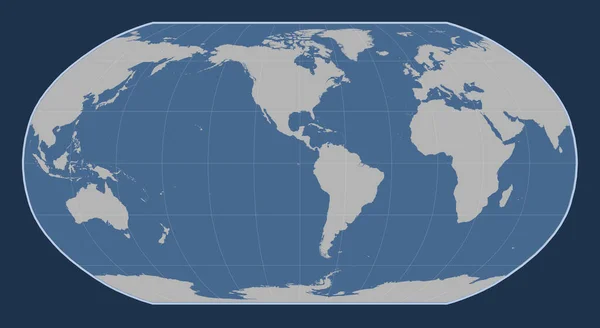
World Solid Contour Map In The Robinson Projection Centered On The 90th Meridian West Longitude
Image, 1.54MB, 4800 × 2625 jpg

Somalian Tectonic Plate On The Bilevel Elevation Map In The Compact Miller Projection Centered Meridionally.
Image, 7.2MB, 4800 × 3010 jpg
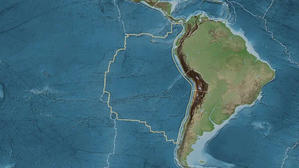
Area Of The Nazca Tectonic Plate Marked With A Solid Line On A Pale Colored Elevation Map In The Patterson Cylindrical Projection
Image, 7.51MB, 3840 × 2160 jpg
Satellite Imagery Map Of The World In The Patterson Cylindrical Projection Transformed To The Center Of The Rivera Tectonic Plate
Image, 6.56MB, 3840 × 2160 jpg


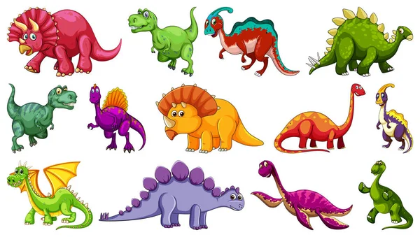
Set Of Different Dinosaur Cartoon Character Isolated On White Background Illustration
Vector, 2.65MB, 6563 × 3719 eps
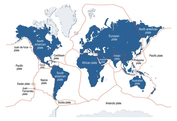
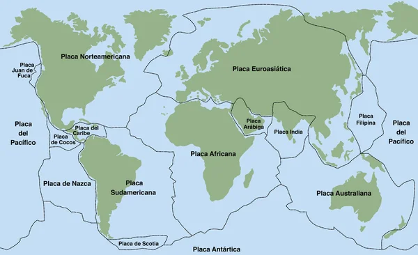
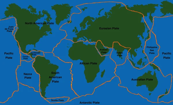
Tectonic Plate. Earth's Lithosphere. Scientific Theory. World Map With Major An Minor Plates. Vector Illustration.
Vector, 3.69MB, 5570 × 3811 eps
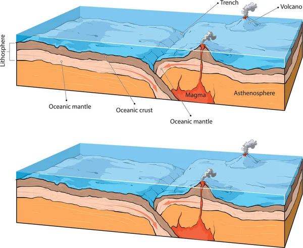
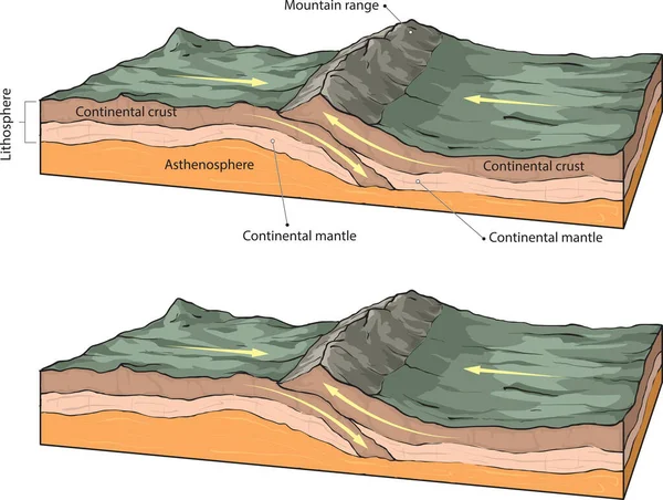

Lithosphere And The Structure Of The Earth. Concept Geography Geology Background. Layers And Cross Section Of Tectonic Plates. The Scheme Of The Movement Of Continents And The Formation Of Mountains.
Vector, 8.44MB, 5500 × 4279 eps

Lithosphere And The Structure Of The Earth. Soil And Limestone. Geography Geology Background. Layers Of Tectonic Plates. The Scheme Of The Movement Of Continents And The Formation Of Mountains.
Vector, 8.39MB, 5500 × 4048 eps
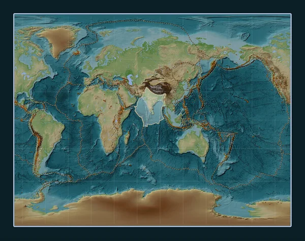
Indian Tectonic Plate On The Wiki Style Elevation Map In The Gall Stereographic Projection Centered Meridionally. Distribution Of Known Volcanoes
Image, 13.86MB, 4800 × 3792 jpg
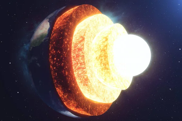
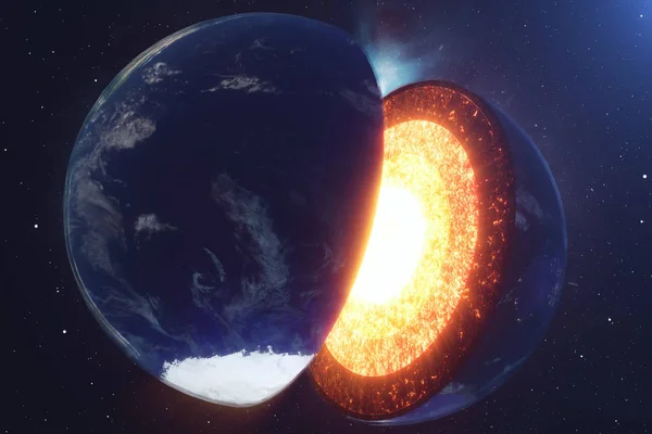
Structure Core Earth. Structure Layers Of The Earth. The Structure Of The Earths Crust. Earth Cross Section In Space View. Elements Of This Image Furnished By NASA. 3D Rendering.
Image, 12.29MB, 6000 × 4000 jpg
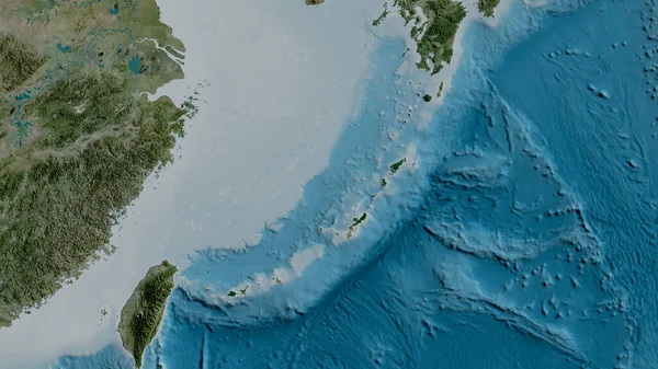
Satellite Map Of The Area Around The Okinawa Tectonic Plate. 3D Rendering
Image, 4.05MB, 2880 × 1620 jpg
Set Of Different Dinosaur Cartoon Character Isolated On White Background Illustration
Vector, 2.87MB, 6565 × 3721 eps


White Line Earth Core Structure Crust Icon Isolated With Long Shadow Background. Red Circle Button. Vector
Vector, 0.43MB, 4000 × 4000 eps


Page 1 >> Next