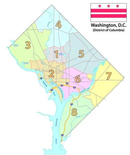
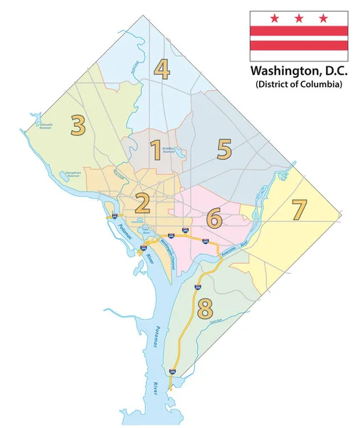
Stock vector Map of the Eight Districts of Washington DC with flag
Published: Nov.18, 2019 11:27:21
Author: Lesniewski
Views: 36
Downloads: 2
File type: vector / eps
File size: 1.07 MB
Orginal size: 3100 x 3644 px
Available sizes:
Level: bronze