Home
Images
Vectors
Videos
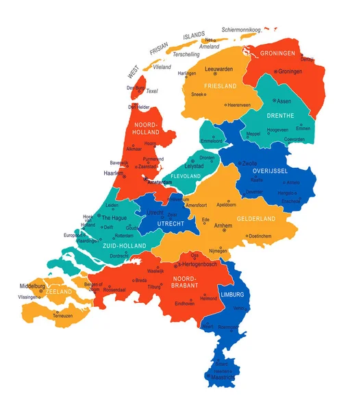
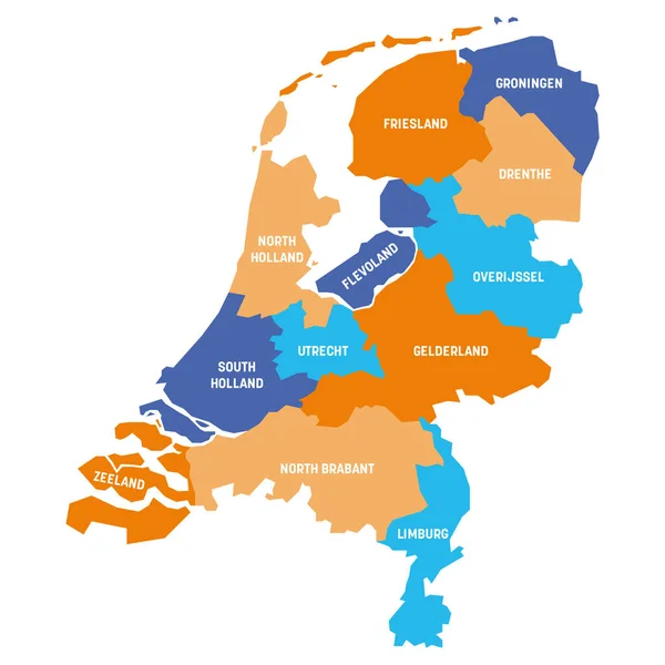
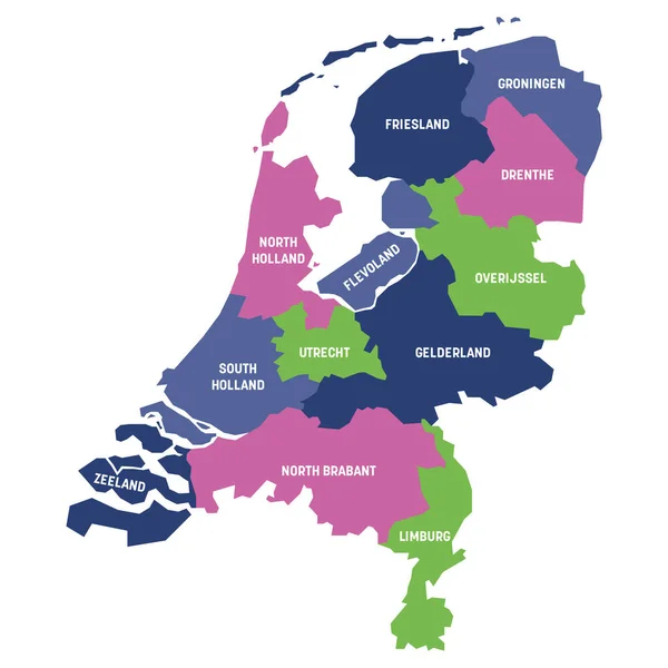
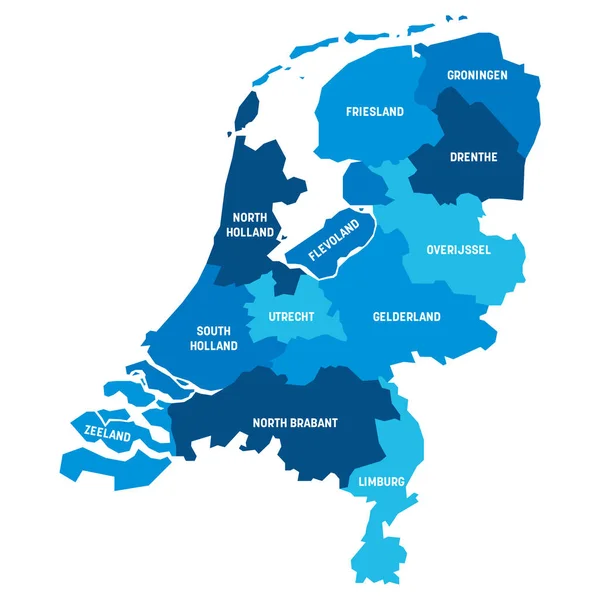
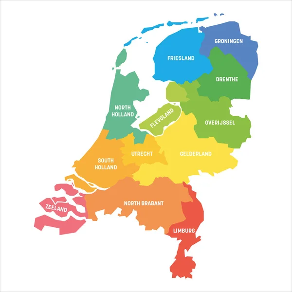
Stock vector Map of the Netherlands with administrative divisions of the country into regional groups of provinces, detailed vector illustration
Published:
Jan.24, 2022 07:42:00
Author:
martinova4
Views:
2
Downloads:
0
File type:
vector
/
eps
File size:
1.66 MB
Orginal size:
7677
x
8074
px
Available sizes:
S
(475 x 500)
M
(951 x 1000)
L
(1902 x 2000)
XL
(7677 x 8074)
VECT
(7677 x 8074)
EL0
(7677 x 8074)
Level:
beginner
Download Vector
Vector topics:
Vector
Background
Illustration
Travel
Sea
Border
Concept
Netherlands
Holland
Northern
Europe
East
South
Navigation
West
Map
Cartography
Geography
Area
Port
Groups
Political
Administrative
Atlas
Province
Amsterdam
Rotterdam
Regional
Haarlem
Provinces
Regions
Hague
Limburg
Gelderland
Zeeland
Friesland
Eindhoven
Middelburg
Drenthe
Utrecht
Groningen
Flevoland
Westland
Overijssel
North Brabant
Zwolle
Venlo
Nijmegen
Zoetemeer
Similar stock vectors
Netherlands Map - High Details Vector Illustration
4911 × 5731
Netherlands - Map Of Provinces
6000 × 6000
Netherlands - Map Of Provinces
6000 × 6000
Netherlands - Map Of Provinces
6000 × 6000
Netherlands - Map Of Provinces
6000 × 6000
Netherlands - Map Of Provinces
6000 × 6000
Netherlands - Map Of Provinces
6000 × 6000
Netherlands Regions Map Vector
5200 × 5200