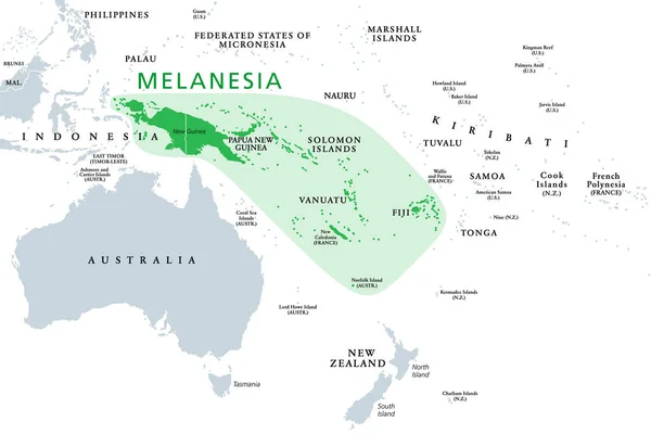
Stock vector Melanesia, subregion of Oceania, political map. Extending from New Guinea in southwestern Pacific Ocean to Tonga, including Fiji, Vanuatu, Solomon Islands and Papua New Guinea. Illustration. Vector.
Published: May.15, 2020 06:43:11
Author: Furian
Views: 149
Downloads: 2
File type: vector / eps
File size: 2.46 MB
Orginal size: 9000 x 6000 px
Available sizes:
Level: silver