Home
Images
Vectors
Videos
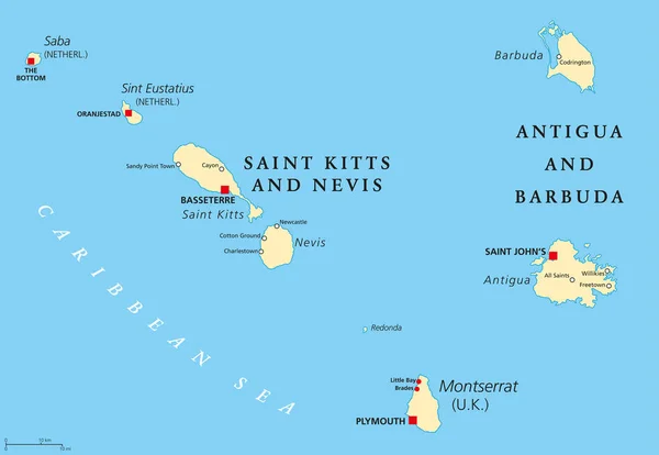
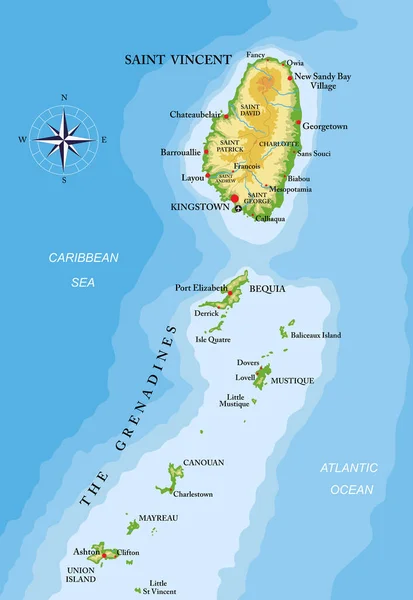
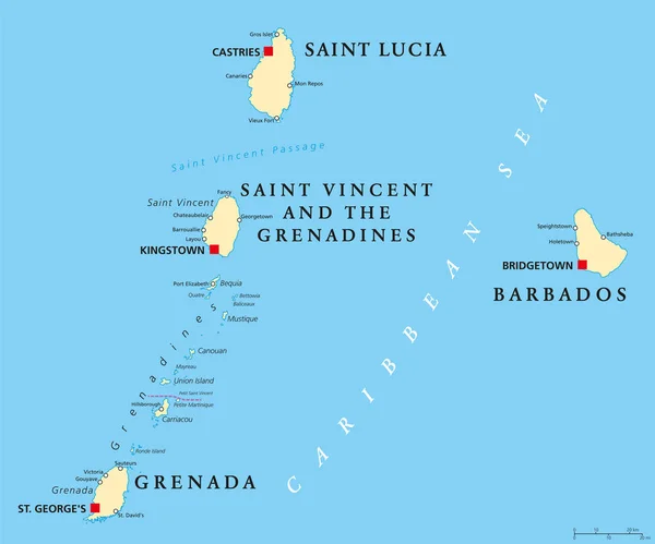
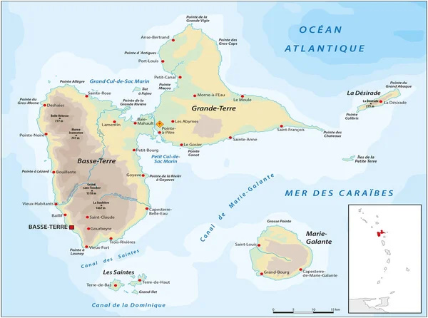
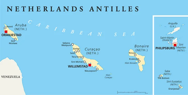
Stock vector Netherlands Antilles Political Map
Published:
Apr.09, 2015 09:32:08
Author:
Furian
Views:
1311
Downloads:
21
File type:
vector
/
eps
File size:
0.67 MB
Orginal size:
9000
x
4567
px
Available sizes:
S
(500 x 254)
M
(1000 x 507)
L
(2000 x 1015)
XL
(9000 x 4567)
VECT
(9000 x 4567)
EL0
(9000 x 4567)
Level:
silver
Download Vector
Vector topics:
Illustration
Travel
Abstract
Netherlands
Coastline
Capital
Europe
Cruise
Map
Cartography
Geography
Island
Destination
Caribbean
Atlas
Americas
Aruba
Saint Martin
Curacao
Newport
Antilles
Anguilla
Saba
Bonaire
Soto
Noord
Oranjestad
Willemstad
Tropical Climate
Dutch Antilles
Lesser Antilles
Leeward Islands
Sint Maarten
Kralendijk
ABC Islands
Netherlands Antilles
Sint Eustatius
Political Map
Philipsburg
Cruise Destination
Windward Islands
Dutch Caribbean
Sint Michiel
Similar stock vectors
Saint Kitts, Nevis, Antigua, Barbuda And Montserrat Political Map
9666 × 6673
St. Vincent And The Grenadines Islands Highly Detailed Physical Map
5170 × 7500
Barbados, Grenada, Saint Lucia And Saint Vincent Political Map
8777 × 7301
Map Of The ABC Islands In The Caribbean Sea
4891 × 3100
Vector Map Of French Overseas Territory Guadeloupe
4168 × 3100
Map Of The Union Of The Comoros And Mayotte
4000 × 3869
Saint Vincent And The Grenadines Vector Map
3100 × 5650
Location Map Of The ABC Islands In The Caribbean Sea
5024 × 3152