Home
Images
Vectors
Videos
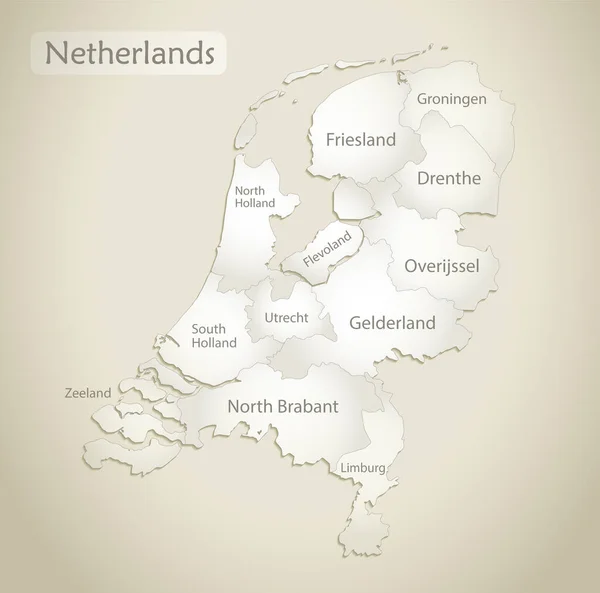
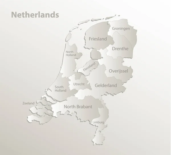
Stock vector Netherlands map, administrative division, separate regions with names of individual regions, card paper 3D natural vector
Published:
Feb.01, 2021 11:45:08
Author:
Mondi.h
Views:
0
Downloads:
0
File type:
vector
/
eps
File size:
2.17 MB
Orginal size:
4410
x
4000
px
Available sizes:
S
(500 x 454)
M
(1000 x 907)
L
(2000 x 1814)
XL
(4410 x 4000)
VECT
(4410 x 4000)
EL0
(4410 x 4000)
Level:
bronze
Download Vector
Vector topics:
Vector
Background
Object
Graphic
Illustration
Design
Paper
Travel
Abstract
Texture
Natural
European
Silhouette
Card
3d
Concept
City
Text
Contour
Wallpaper
Earth
World
Netherlands
Holland
Template
Tourism
Europe
Name
Outline
Country
Map
Cartography
Geography
Continent
Papery
State
Poster
Political
Administrative
Politics
Region
Territory
Atlas
Province
Dutch
Regions
Netherlandish
Administrative Divisions
Kingdom Of The Netherlands
Netherlands Map
Similar stock vectors
Netherlands Map, Administrative Division With Names, Old Paper Background Vector
4045 × 4000
Black Map Of Netherlands With Names Of Regions, Design Blackboard Vector
4306 × 4000
The Detailed Map Of Netherlands With Regions Or States And Cities, Capital. Administrative Division.
5000 × 6000
Labeled Colorful Provinces Map Of European Country Of Netherlands
3600 × 4800
Netherlands Provinces Map
4324 × 5000
Netherlands Map And Flag, Administrative Division, Separates Regions And Names Individual Region, Design Glass Card 3D Vector
4554 × 4000
Netherlands - Map And Flag Illustration
5900 × 7258
Netherlands Map Silhouette White Icon
4521 × 4521