Home
Images
Vectors
Videos
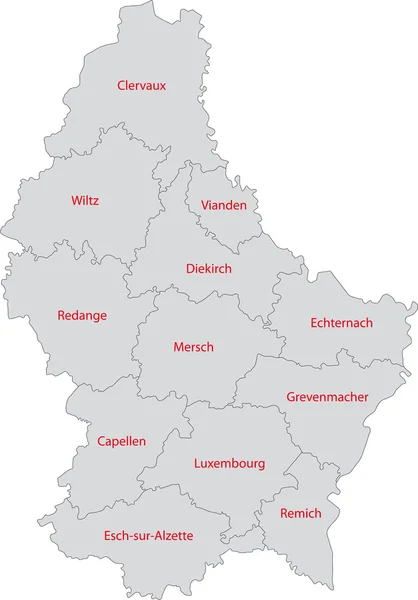
Stock vector Outline Luxembourg map
Published:
Oct.02, 2013 10:24:42
Author:
Volina
Views:
712
Downloads:
0
File type:
vector
/
eps
File size:
2.95 MB
Orginal size:
4191
x
6004
px
Available sizes:
S
(349 x 500)
M
(698 x 1000)
L
(1396 x 2000)
XL
(4191 x 6004)
VECT
(4191 x 6004)
EL0
(4191 x 6004)
Level:
silver
Download Vector
Vector topics:
Element
Illustration
Design
Isolated
Travel
Detail
Maple
Cutout
European
Silhouette
Border
Grand
Symbol
City
Contour
Detailed
Europe
Outline
Country
District
Map
Geography
National
Continent
State
Location
Boundary
Political
Administrative
Of
Region
Division
The
Territory
Atlas
Province
County
Luxembourg
Duchy
Territories
Luxembourgish
Landlocked
Politically
Luxembourger
Geographically
Similar stock vectors
Luxembourg
4049 × 5800
Belgium Map
6810 × 5565
Dark Gray Flat Vector Administrative Map Of KIEL, GERMANY With Name Tags And White Border Lines Of Its Districts
3802 × 6405
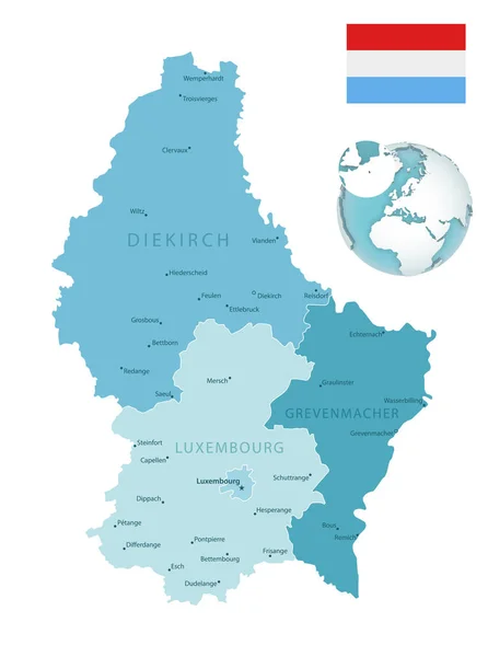
Luxembourg Administrative Blue-green Map With Country Flag And Location On A Globe. Vector Illustration
5251 × 7052
Detailed Map Of The Belgium With Cities
4000 × 4000
Visualisation The Urban District And Administrative District Of Brandenburg. Colored Background.
2357 × 2348
White Flat Vector Administrative Map Of ERLANGEN, GERMANY With Name Tags And Black Border Lines Of Its Districts
4398 × 5511
Vector Map Of The European Economic Region Regiotrirhena, France, Switzerland And Germany
3100 × 4006