Home
Images
Vectors
Videos
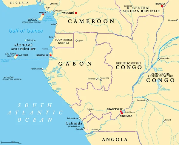
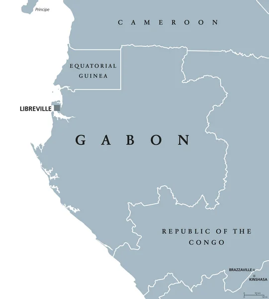
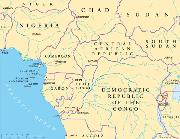
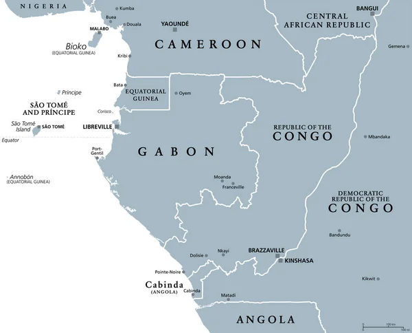
Stock vector Part of Central Africa, subregion of the African continent, gray political map, with capitals, borders and largest cities. Gabon, Republic of the Congo, Sao Tome and Principe, and Equatorial Guinea.
Published:
Sep.07, 2023 12:33:11
Author:
Furian
Views:
1
Downloads:
0
File type:
vector
/
eps
File size:
3.07 MB
Orginal size:
7430
x
6000
px
Available sizes:
S
(500 x 404)
M
(1000 x 808)
L
(2000 x 1615)
XL
(7430 x 6000)
VECT
(7430 x 6000)
EL0
(7430 x 6000)
Level:
silver
Download Vector
Vector topics:
Vector
Illustration
Border
African
Gray
City
Capital
Country
Map
Cartography
Geography
Area
Africa
Continent
Land
Overview
State
Boundary
Island
Republic
Region
Central
Atlas
Equator
Mapping
Gabon
Congo
Cameroon
Angola
Principe
Yaounde
Libreville
Bangui
Malabo
Kinshasa
Brazzaville
Cabinda
Infographic
CENTRAL AFRICAN REPUBLIC
Atlantic Ocean
Equatorial Guinea
Sao Tome
Central Africa
Bioko
Ogooue
Political Map
Subregion
Democratic Republic
Congo River
Port Gentil
Similar stock vectors
Part Of Central Africa, A Subregion Of The African Continent, Political Map, With Capitals, Borders And Largest Cities. Gabon, The Republic Of The Congo, Sao Tome And Principe, And Equatorial Guinea.
7430 × 6000
Republic Of The Congo, Political Map. Also Known As The Congo, Is A Country Located On The Western Coast Of Central Africa, To The West Of The Congo River, With The Capital Brazzaville. Vector.
6000 × 6838
FRANKFURT, GERMANY-MAY 31, 2021: Houses Of The Former Workers Settlement Colonie, Frankfurt-Zeilsheim, Germany
3100 × 4871
Republic Of The Congo Political Map
7487 × 8555
Congo Republic Highly Detailed Physical Map
7113 × 7500
Republic Of The Congo Political Map
6446 × 6000
Gabon Political Map
7550 × 8366
West Central Africa Political Map
7726 × 6000