Home
Images
Vectors
Videos
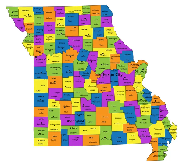
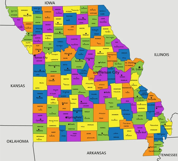
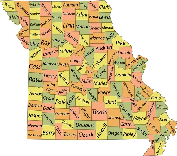
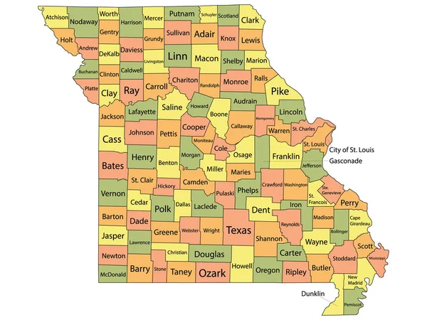
Stock vector Pastel vector map of the Federal State of Missouri, USA with black borders and name tags of its counties
Published:
Sep.20, 2021 07:15:33
Author:
momcilo.jovanov
Views:
2
Downloads:
0
File type:
vector
/
eps
File size:
1.79 MB
Orginal size:
5304
x
4664
px
Available sizes:
S
(500 x 440)
M
(1000 x 879)
L
(2000 x 1759)
XL
(5304 x 4664)
VECT
(5304 x 4664)
EL0
(5304 x 4664)
Level:
bronze
Download Vector
Vector topics:
Vector
Illustration
Design
Sign
Travel
Mountain
Flag
Road
Position
Symbol
Icon
City
Usa
Journey
Outline
District
Direction
Map
Cartography
Land
Topography
Unity
Division
Voting
Insignia
Election
Missouri
Coat Of Arms
Cut Out
Travel Destinations
National Flag
No People
Physical Geography
Line Art
Washington Dc
Jefferson City
Eastern USA
Western USA
Contour Line
Relief Carving
Relief Map
Topographic Map
Flat Design
In Silhouette
Similar stock vectors
Colorful County Map With Counties Names Of The US Federal State Of Missouri
4800 × 3600
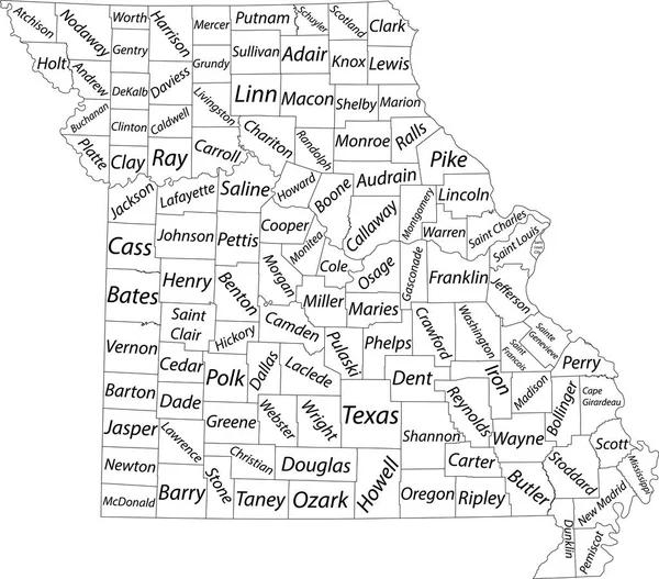
White Vector Map Of The Federal State Of Missouri, USA With Black Borders And Name Tags Of Its Counties
5304 × 4664
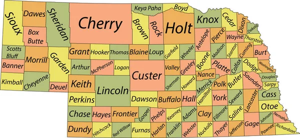
Pastel Vector Map Of The Federal State Of Nebraska, USA With Black Borders And Name Tags Of Its Counties
7306 × 3365
Pastel Vector Administrative Map Of The Federal State Of South Dakota, USA With Black Borders And Name Tags Of Its Counties
6106 × 3760
Colorful County Map With Counties Names Of The US Federal State Of Illinois
3600 × 4800
White Outline Counties Map With Counties Names Of US State Of Missouri
4800 × 3600
Colorful Missouri Political Map With Clearly Labeled, Separated Layers. Vector Illustration.
4680 × 4248
Colorful Missouri Political Map With Clearly Labeled, Separated Layers. Vector Illustration.
4675 × 4245