Home
Images
Vectors
Videos
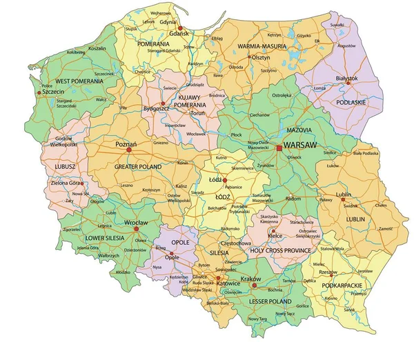
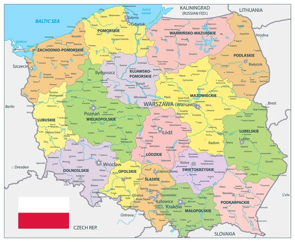
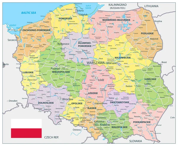
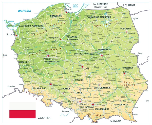
Stock vector Poland Political Map Isolated on white
Published:
Apr.19, 2019 09:26:58
Author:
Cartarium
Views:
41
Downloads:
4
File type:
vector
/
eps
File size:
4.45 MB
Orginal size:
5086
x
4176
px
Available sizes:
S
(500 x 411)
M
(1000 x 821)
L
(2000 x 1642)
XL
(5086 x 4176)
VECT
(5086 x 4176)
EL0
(5086 x 4176)
Level:
bronze
Download Vector
Vector topics:
Color
Image
Yellow
White
Blue
Vector
Background
Colorful
Graphic
Element
Illustration
Design
Shape
Travel
Detail
Sea
European
Silhouette
Border
Symbol
City
Contour
World
Capital
Europe
Outline
Country
District
Map
Geography
Land
State
Political
Administrative
Republic
Region
Poland
Maps
Nation
County
Rivers
Isolated On White
Similar stock vectors
Poland - Highly Detailed Editable Political Map With Labeling.
5670 × 4691
Poland Political Map
5086 × 4176
Poland Detail Administrative Map And Roads
5086 × 4176
Poland Physical Map Isolated On White
5812 × 4764
Belgium - Highly Detailed Editable Political Map With Labeling.
5404 × 4252
Colorful Belgium Political Map With Clearly Labeled, Separated Layers. Vector Illustration.
5404 × 4252
Ukraine - Highly Detailed Editable Political Map With Labeling.
5673 × 4010
Administrative Vector Map Of Belgium Regions, Provinces And Districts
4000 × 3256