Home
Images
Vectors
Videos
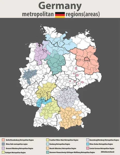
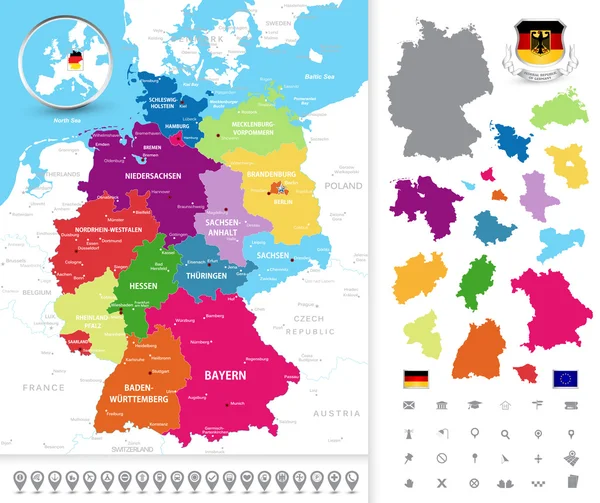
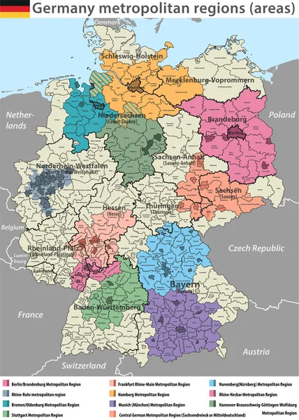
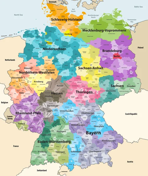
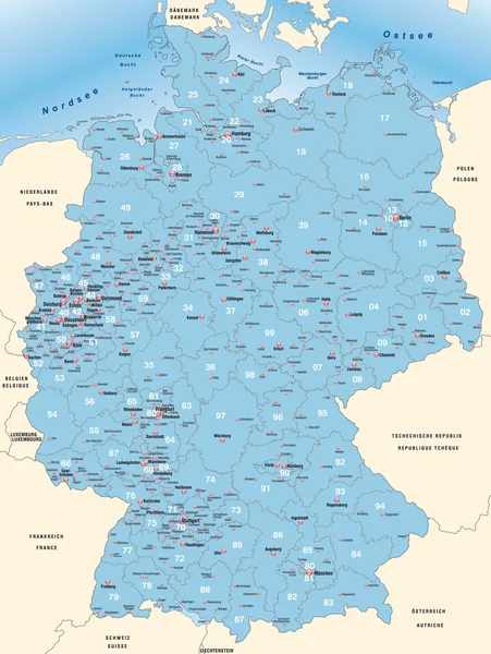
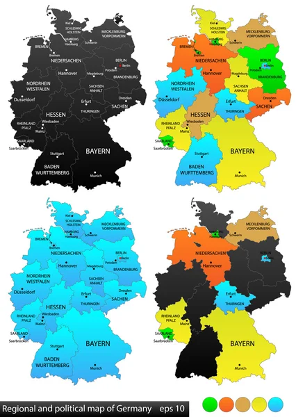
Stock vector Political and location map of Germany. Versatile file, every piece is selectable and editable in layers panel. Turn on and off visibility of every province in one click. Vector, eps 10.
Published:
Sep.10, 2014 13:57:05
Author:
Ivsanmas
Views:
315
Downloads:
1
File type:
vector
/
eps
File size:
2.84 MB
Orginal size:
3840
x
5400
px
Available sizes:
S
(356 x 500)
M
(711 x 1000)
L
(1422 x 2000)
XL
(3840 x 5400)
VECT
(3840 x 5400)
EL0
(3840 x 5400)
Level:
bronze
Download Vector
Vector topics:
Image
Vector
Background
Colorful
Graphic
Illustration
Design
Travel
European
Black
Silhouette
Border
Concept
World
Europe
Country
German
District
Map
Geography
National
Germany
Land
Worldwide
State
Location
Administrative
Union
Internal
Berlin
Deutschland
Central
Cities
Editable
Boundaries
Versatile
Bavaria
Province
Nation
Brandenburg
Bremen
Hamburg
Regions
Infographics
Eps 10
Map Of Germany
Similar stock vectors
Vector High Detailed Map Of Germany Metropolitan Regions (areas)
6456 × 8334
Political Map Of Germany
6392 × 5368
Vector High Detailed Map Of Germany Metropolitan Regions (areas)
5888 × 8250
Germany High Detailed Vector Map With Neighbouring Countries And Territories. Map Colored By States And Administrative Districts, With Subdivisions
6975 × 8333
Germany High Detailed Vector Map (colored By States And Administrative Districts) With Subdivisions. All Layers Detachable And Labeled.
7292 × 8512
Vector Colorful Map Of Germany
6000 × 5989
Map Of Germany
3468 × 4614
West European Country Germany And The Federal States
7333 × 9685