Home
Images
Vectors
Videos
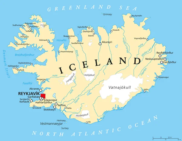
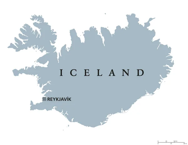
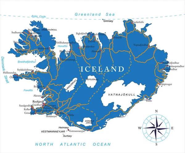
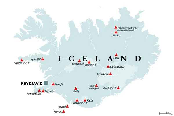
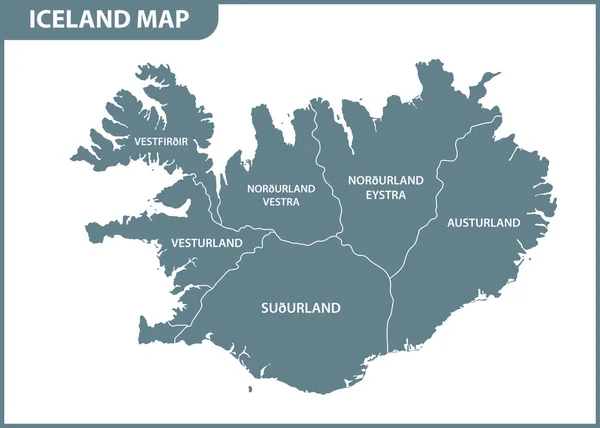
Stock vector Regions of Iceland, gray political map, with capital Reykjavik. Eight regions and their seats, used for statistical purposes. Nordic island country in Atlantic Ocean. Isolated illustration. Vector.
Published:
Apr.24, 2023 11:50:20
Author:
Furian
Views:
33
Downloads:
5
File type:
vector
/
eps
File size:
2.65 MB
Orginal size:
7729
x
6000
px
Available sizes:
S
(500 x 388)
M
(1000 x 776)
L
(2000 x 1553)
XL
(7729 x 6000)
VECT
(7729 x 6000)
EL0
(7729 x 6000)
Level:
silver
Download Vector
Vector topics:
Vector
Illustration
Isolated
Gray
City
Coast
Coastline
Capital
North
Europe
Eastern
Country
Western
Map
Cartography
Geography
Geology
Seat
Nordic
Island
Political
Arctic
Atlantic
Republic
Region
Administration
Atlas
Peninsula
Mapping
Iceland
Northwestern
Northeastern
Seismic
Regions
Icelandic
Reykjavik
Volcanism
Keflavik
Akureyri
Selfoss
Egilsstadir
Borgarnes
Atlantic Ocean
Westfjords
Saudarkrokur
Greenland Sea
Iceland Map
Capital Region
Southern Peninsula
Isarfjordur
Similar stock vectors
Iceland Political Map
7729 × 6000
Iceland Political Map
9111 × 7073
Regions Of Iceland, Political Map, With Capital Reykjavik. Eight Regions And Their Seats, Used For Statistical Purposes. Nordic Island Country In Atlantic Ocean. English Labeling. Illustration. Vector
4000 × 3738
Highly Detailed Vector Map Of Iceland With Administrative Regions,main Cities And Roads.
5000 × 4122
Volcanoes Of Iceland That Erupted Since Human Settlement, Political Map. Eighteen Volcanoes Shown On Gray Map Of Iceland, With Glaciers And Regions. Isolated Illustration On White Background. Vector.
4000 × 3605
Vector Iceland Map
6941 × 4830
Iceland - Vector Map
4859 × 5026
The Detailed Map Of Iceland With Regions Or States. Administrative Division
7000 × 5000