Home
Images
Vectors
Videos
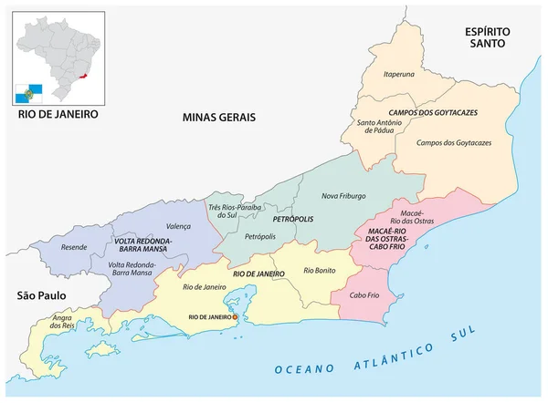
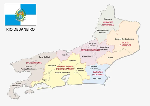
Stock vector Rio de Janeiro administrative an political map with flag
Published:
Apr.13, 2017 06:35:41
Author:
Lesniewski
Views:
767
Downloads:
42
File type:
vector
/
eps
File size:
1.16 MB
Orginal size:
4372
x
3100
px
Available sizes:
S
(500 x 355)
M
(1000 x 709)
L
(2000 x 1418)
XL
(4372 x 3100)
VECT
(4372 x 3100)
EL0
(4372 x 3100)
Level:
bronze
Download Vector
Vector topics:
Vector
Colorful
Graphic
Border
Flag
Symbol
Icon
South
Outline
Map
Cartography
Geography
State
America
Political
Region
Brazil
Mapping
South America
Administrativ
Rio De Janeiro
Microregion
Mesoregion
Similar stock vectors
Map Of The Central And Immediate Geographic Regions Of Rio De Janeiro, Brazil
4202 × 3100
The Map Is Designed In A Modern Way And Contains All The Important Topographical Information ... The Map Can Be Used Immediately And Is Optimized For Printing And Use In Digital Media. The Color Mode Is Rgb.
3712 × 5728
Administrative Map Of The Portuguese Island Of Madeira With Flag
5894 × 3100
Santa Catarina Road And Administrative Map Brazil
4475 × 3100
Sertao Map, Brazil, Vector Illustration
6336 × 7440
Map Of The Central And Immediate Geographic Regions Of Santa Catarina, Brazil
4695 × 3100
Detailed Street Map Of Brazilian Island Santa Catarina, Santa Catarina, Brazil
3100 × 4832
Map Of Portugal
3400 × 4996