Home
Images
Vectors
Videos
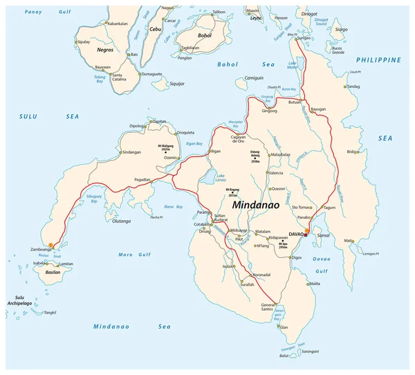
Stock vector Road map of the second largest Philippine island Mindanao
Published:
May.29, 2017 08:46:09
Author:
Lesniewski
Views:
417
Downloads:
2
File type:
vector
/
eps
File size:
1.43 MB
Orginal size:
3427
x
3100
px
Available sizes:
S
(500 x 452)
M
(1000 x 905)
L
(2000 x 1809)
XL
(3427 x 3100)
VECT
(3427 x 3100)
EL0
(3427 x 3100)
Level:
bronze
Download Vector
Vector topics:
Travel
Coastal
Map
Asia
Groups
Airport
Islands
Southern
Territory
Philippine
Mindanao
Davao
Sulu Sea
Philippine Sea
Mindanao Sea
Similar stock vectors
Map Of The Second Largest Philippine Island Mindanao
3427 × 3100
Thailand Road Vector Map
3180 × 4675
Thailand Map - Vintage Vector Illustration
5500 × 8003
Map Of The Autonomous Monastic State Of The Holy Mountain, Greece
4672 × 4456
Vector Road Map Of The Chilean Island Of Chiloe, Chile
3100 × 3570
Abkhazia Road Vector Map.
4089 × 3100
Estonia - Highly Detailed Editable Political Map With Labeling.
3002 × 2015