Home
Images
Vectors
Videos
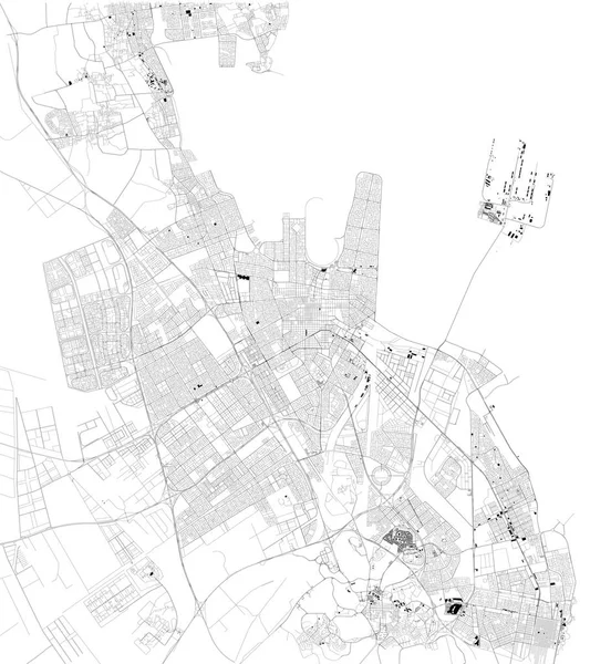
Stock vector Satellite map of Boa Vista, Roraima, Brazil. Map of streets and buildings of the town center. South America
Published:
Aug.07, 2019 09:48:19
Author:
vampy1
Views:
27
Downloads:
0
File type:
vector
/
eps
File size:
4.03 MB
Orginal size:
10659
x
8326
px
Available sizes:
S
(500 x 391)
M
(1000 x 781)
L
(2000 x 1562)
XL
(10659 x 8326)
VECT
(10659 x 8326)
EL0
(10659 x 8326)
Level:
silver
Download Vector
Vector topics:
White
Background
Design
Isolated
Sign
Travel
Transportation
Black
Border
Traffic
Symbol
Architecture
Building
City
Urban
Lines
Information
Attention
Highway
Landmark
Outline
Country
District
Map
Warning
Buildings
Chart
Poster
Touristic
Destination
Welcome
Republic
Signpost
Brazil
Atlas
Democratic
Ministry
Roraima
Top View
South America
Aerial View
City Map
Boa Vista
Satellite Map
Similar stock vectors
Satellite Map Of Thessaloniki, It Is Is The Second-largest City In Greece. Map Of Streets And Buildings Of The Town Center. Europe
7773 × 7106
Satellite Map Of Juba, It Is The Capital And Largest City In The Republic Of South Sudan. The City Is Situated On The White Nile. Map Of Streets And Buildings Of The Town Center
8268 × 7517
Satellite Map Of Aden, It Is A Port City Of Yemen, Located By The Eastern Approach To The Red Sea, Aden's Natural Harbour Lies In The Crater Of A Dormant Volcano. Map Of Streets And Buildings Of The Town Center
8429 × 5992
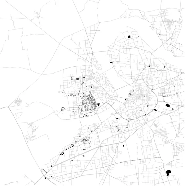
Map Of Fez, Morocco, Satellite View, Black And White Map. Street Directory And City Map. Africa
4717 × 4717
Satellite Map Of Dammam. It Is The Capital Of The Eastern Province Of Saudi Arabia. Map Of Streets And Buildings Of The Town Center. Asia
8609 × 9673
Urban City Map Of Las Palmas De Gran Canaria. Vector Illustration, Las Palmas Map Grayscale Art Poster. Street Map Image With Roads, Metropolitan City Area View.
4001 × 4001
Map Of Surat, Gujarat, Satellite View, Black And White Map. Street Directory And City Map. India
10296 × 10335
Streets Of Rabat, City Map, Capital, Morocco, Satellite View. Street
6659 × 4992