Home
Images
Vectors
Videos
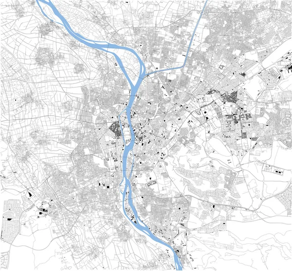
Stock vector Satellite map of Cairo, it is the capital of Egypt, associated with ancient Egypt, as the famous Giza pyramid complex. The city is situated on the Nile river. Map of streets and buildings of the town center.
Published:
Aug.01, 2019 06:33:05
Author:
vampy1
Views:
158
Downloads:
2
File type:
vector
/
eps
File size:
20.37 MB
Orginal size:
7087
x
6596
px
Available sizes:
S
(500 x 465)
M
(1000 x 931)
L
(2000 x 1861)
XL
(7087 x 6596)
VECT
(7087 x 6596)
EL0
(7087 x 6596)
Level:
silver
Download Vector
Vector topics:
White
Background
Design
Isolated
Sign
Travel
Transportation
Black
Border
Traffic
River
Symbol
Architecture
Building
City
Urban
Lines
Information
Attention
Highway
Landmark
Outline
Country
District
Map
Africa
Egypt
Warning
Buildings
Chart
Poster
Touristic
Destination
Welcome
Republic
Cairo
Signpost
Atlas
Nile
Democratic
Ministry
Top View
Aerial View
City Map
Giza Pyramid
Satellite Map
Similar stock vectors
Satellite Map Of Isfahan, Iran, City Streets. Street Map, City Center. Asia
10395 × 5992
Rome Map Satellite View Italy
4439 × 3328
Rome Map Satellite View Italy
4439 × 3328
Satellite Map Of Hanoi, Vietnam, City Streets. Street Map, City Center. Asia
7579 × 8146
Satellite Map Of Juba, It Is The Capital And Largest City In The Republic Of South Sudan. The City Is Situated On The White Nile. Map Of Streets And Buildings Of The Town Center
8268 × 7517
Satellite View On The Map Of Milan
4439 × 3328
Vector Map Of The City Of Birmingham, Wolverhampton, English Midlands, United Kingdom, England
6079 × 4959