Home
Images
Vectors
Videos
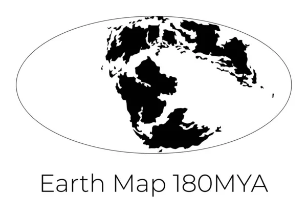
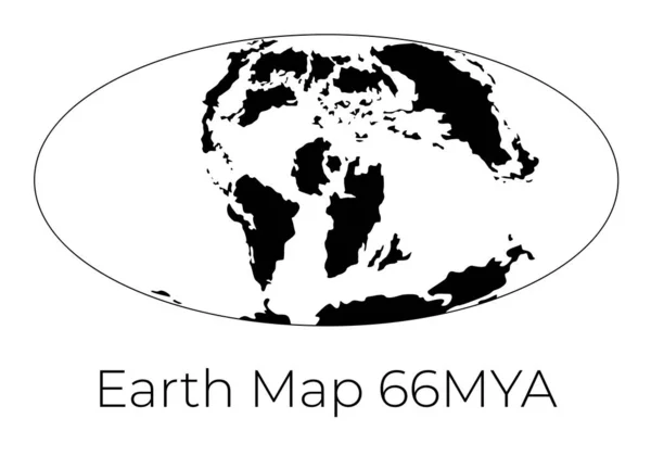
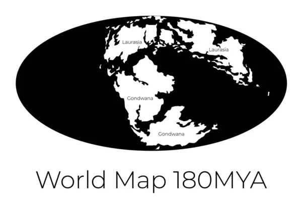
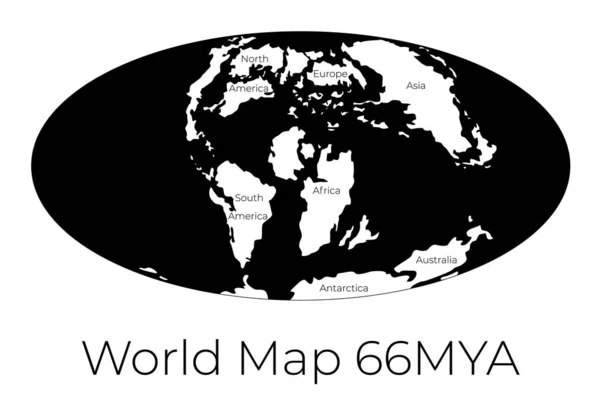
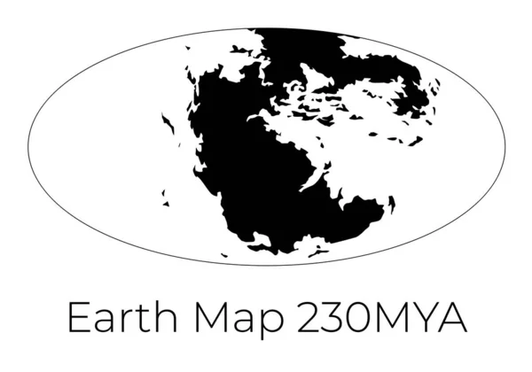
Stock vector Silhouette of Map of the Earth 230MYA. Monochrome vector illustration of Earth map with black continents and white oceans isolated on white background. Projection. Prehistoric worldmap.
Published:
Dec.13, 2019 09:28:31
Author:
tinki.v
Views:
47
Downloads:
1
File type:
vector
/
eps
File size:
0.93 MB
Orginal size:
7143
x
5000
px
Available sizes:
S
(500 x 350)
M
(1000 x 700)
L
(2000 x 1400)
XL
(7143 x 5000)
VECT
(7143 x 5000)
EL0
(7143 x 5000)
Level:
beginner
Download Vector
Vector topics:
White
Vector
Background
Graphic
Illustration
Design
Isolated
Art
Abstract
Water
Black
Silhouette
Symbol
Global
Flat
Education
Earth
Planet
World
Template
Ocean
Ancient
North
East
South
Stencil
West
Map
Cartography
Geography
History
Continent
Land
Move
Past
Topography
Plane
Projection
Period
Prehistoric
Drift
Ago
Worldmap
Tectonic
Earth Map
Mya
Continental Drift
230mya
Similar stock vectors
Silhouette Of Map Of The Earth 180MYA. Monochrome Vector Illustration Of Earth Map With Black Continents And White Oceans Isolated On White Background. Projection. Prehistoric Worldmap.
7143 × 5000
Silhouette Of Map Of The Earth 66MYA. Monochrome Vector Illustration Of Earth Map With Black Continents And White Oceans Isolated On White Background. Projection. Prehistoric Worldmap.
7143 × 5000
Map Of The World 180MYA. Monochrome Vector Illustration Of Worldmap With White Continents And Black Oceans Isolated On White Background. Prehistoric Projection. Silhouette. Element For Your Design.
7143 × 5000
Vector Contour Dotted Map Of Earth With Caption
6692 × 3600
Map Of The World 66MYA. Monochrome Vector Illustration Of Worldmap With White Continents And Black Oceans Isolated On White Background. Prehistoric Projection. Silhouette. Element For Your Design.
7143 × 5000
World Map Globe In Natural Earth Projection Plain Style Outline Vector Illustration
5230 × 5753
Map Of The World 66MYA. Vector Illustration Of Worldmap With Red Continents And Turquoise Oceans Isolated On Dark Grey Background. Projection. Prehistoric Earth Map. Element For Your Design.
7143 × 5000
World Map In The Fahey Projection Centered On 11 East Longitude. Satellite Imagery A - Composite Of Raster With Graticule And Tectonic Plates Borders. 3D Illustration
4000 × 2000