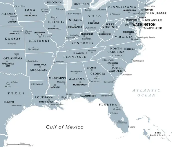
Stock vector Southeast Region, South of the United States, gray political map. Geographic and cultural region, also referred to as the Southern United States, American South, Southland, Dixieland, or simply Dixie.
Published: Apr.23, 2024 12:24:39
Author: Furian
Views: 0
Downloads: 0
File type: vector / eps
File size: 2.58 MB
Orginal size: 7059 x 6000 px
Available sizes:
Level: silver