Home
Images
Vectors
Videos
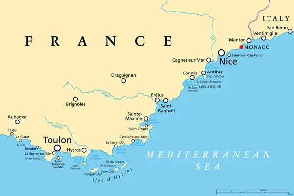
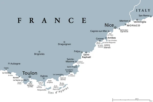
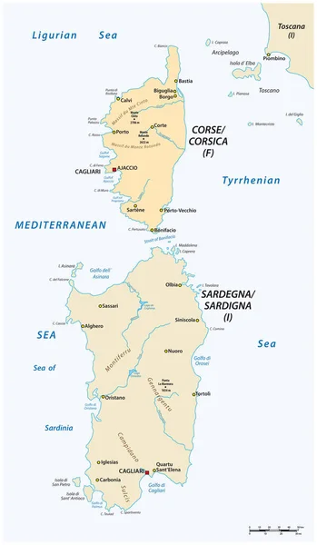
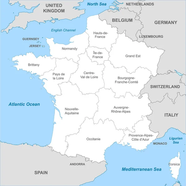
Stock vector Southern France coastline, political map. Southernmost part of France, that border the Mediterranean Sea. Map with part of Occitania, Provence, French Riviera, Corsica, and with most important cities.
Published:
Mar.19, 2024 20:22:23
Author:
Furian
Views:
7
Downloads:
1
File type:
vector
/
eps
File size:
3.28 MB
Orginal size:
9000
x
5999
px
Available sizes:
S
(500 x 333)
M
(1000 x 667)
L
(2000 x 1333)
XL
(9000 x 5999)
VECT
(9000 x 5999)
EL0
(9000 x 5999)
Level:
silver
Download Vector
Vector topics:
Vector
Illustration
Travel
French
Border
Nice
City
Italy
France
Coast
Coastline
Europe
Provence
South
Sailing
Cruise
Country
Map
Cartography
Geography
Mediterranean
Spain
Overview
Island
Destination
Monaco
Atlas
Mapping
Riviera
Marseille
Cannes
Corsica
Rhone
Southernmost
Montpellier
Ajaccio
Perpignan
Toulon
Infographic
Mediterranean Sea
Southern France
Beziers
French Riviera
South France
Ligurian Sea
Political Map
Gulf Of Lion
Occitania
Occitanie
Similar stock vectors
French Riviera, Political Map. Mediterranean Coastline Of The Southeast Corner Of France, Known As Cote DAzur (Azure Coast). Usually Considered To Extend From Toulon In The West To Menton In The East.
9000 × 6000
French Riviera, Gray Political Map. Mediterranean Coastline Of The Southeast Corner Of France, Known As Cote DAzur Or Azure Coast. Considered To Extend From Toulon In The West To Menton In The East.
9000 × 6000
Vector Map Of The Two Mediterranean Sea Islands Of Corsica And Sardinia
3100 × 5317
Political Map Of France With Borders With Borders Of Regions And Countries
4000 × 4000
Bay Of Biscaya Vector Map, France, Spain.
3255 × 3100
Vector Administrative Map Of The Two Maltese Islands Gozo And Comino With Flag, Malta
4000 × 3796
Vector Administrative Map Of The Two Maltese Islands Gozo And Comino With Flag, Malta
4563 × 3100
Bay Of Biscaya Vector Road Map, Spain, France.
3255 × 3100