Home
Images
Vectors
Videos
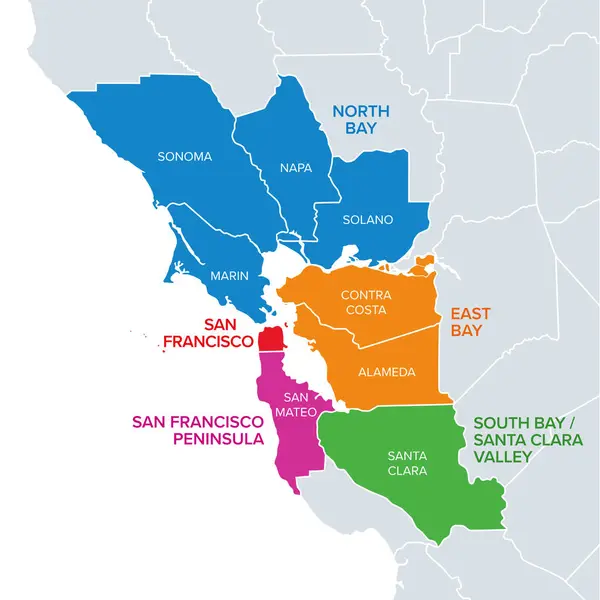
Stock vector Subregions of the San Francisco Bay Area, divided by counties, political map. Area of the U.S. state of California, that surrounds and includes the San Francisco Bay, which is a large tidal estuary.
Published:
Jun.12, 2024 16:34:07
Author:
Furian
Views:
0
Downloads:
0
File type:
vector
/
eps
File size:
2.94 MB
Orginal size:
6000
x
6000
px
Available sizes:
S
(500 x 500)
M
(1000 x 1000)
L
(2000 x 2000)
XL
(6000 x 6000)
VECT
(6000 x 6000)
EL0
(6000 x 6000)
Level:
silver
Download Vector
Vector topics:
Color
Vector
Illustration
Isolated
Travel
Border
Us
Usa
Bay
Country
Map
Cartography
Geography
Area
Pacific
Land
Overview
State
America
Destination
States
Region
Division
California
Atlas
Peninsula
Napa
Californian
County
Marin
Mapping
Sonoma
Solano
Alameda
United States
Santa Clara
San Francisco
Bay Area
East Bay
San Francisco Bay
Political Map
South Bay
Subregion
North Bay
San Mateo
Silicon Valley
Contra Costa
Santa Clara Valley
Sub Region
Similar stock vectors