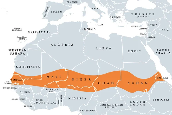
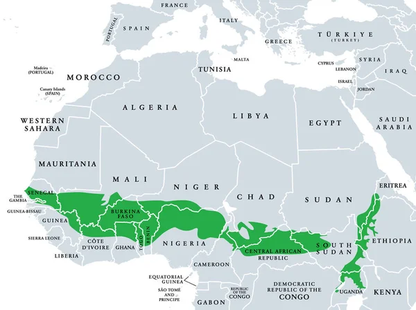
Stock vector Sudanian savanna, political map. Broad belt of tropical savanna across the African continent, divided into two ecoregions. West (Atlantic to Nigeria) and East Sudanian savanna (Cameroon to Ethiopia).
Published: Jul.07, 2023 16:30:43
Author: Furian
Views: 14
Downloads: 0
File type: vector / eps
File size: 2.71 MB
Orginal size: 8019 x 6000 px
Available sizes:
Level: silver