Home
Images
Vectors
Videos
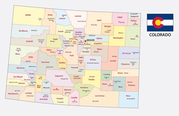
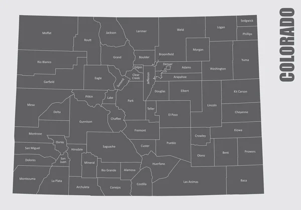
Stock vector The Colorado State counties map with labels
Published:
Mar.06, 2020 13:46:19
Author:
luisrftc
Views:
27
Downloads:
1
File type:
vector
/
eps
File size:
9.33 MB
Orginal size:
5000
x
3500
px
Available sizes:
S
(500 x 350)
M
(1000 x 700)
L
(2000 x 1400)
XL
(5000 x 3500)
VECT
(5000 x 3500)
EL0
(5000 x 3500)
Level:
bronze
Download Vector
Vector topics:
White
Vector
Background
Illustration
Design
Isolated
Shape
Travel
Abstract
Transport
Black
Line
Silhouette
Gray
Symbol
Lines
Contour
Grey
American
Us
Usa
Tourism
North
Outline
Map
Cartography
Geography
Area
State
Location
America
Administrative
United
States
Region
Division
Federal
Labels
County
Colorado
Names
Topographical
Counties
Similar stock vectors
Colorado Administrative And Political Vector Map
4780 × 3100
The New Mexico Counties Map With Labels On White Background
5000 × 5000
The Gray Map Of Wyoming State With Counties And Its Labels
5000 × 3800
Colorado - Vector Map
6348 × 4815
High Quality Map Of Colorado Is A State Of United States Of America With Borders Of The Counties
4000 × 4000
Colorado
4739 × 3578
Colorado, CO Political Map With The Capital Denver, Most Important Rivers And Lakes. State In The Mountain West Subregion Of The Western United States Of America Nicknamed The Centennial State. Vector
7840 × 6000
Colorado State Map With Neighboring States
4202 × 3100