Home
Images
Vectors
Videos
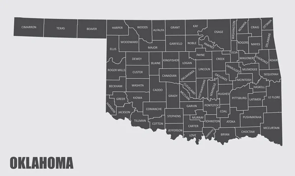
Stock vector The Oklahoma state county map with labels
Published:
Jun.30, 2020 08:41:04
Author:
luisrftc
Views:
1
Downloads:
0
File type:
vector
/
eps
File size:
9.34 MB
Orginal size:
5000
x
3000
px
Available sizes:
S
(500 x 300)
M
(1000 x 600)
L
(2000 x 1200)
XL
(5000 x 3000)
VECT
(5000 x 3000)
EL0
(5000 x 3000)
Level:
bronze
Download Vector
Vector topics:
White
Vector
Background
Illustration
Design
Isolated
Shape
Travel
Abstract
Transport
Black
Dark
Line
Silhouette
Gray
Symbol
Lines
Contour
Grey
Us
Usa
Tourism
North
Outline
Map
Cartography
Geography
Area
State
Location
America
Administrative
United
States
Region
Division
Federal
Labels
County
Names
Oklahoma
Topographical
North America
United States
Similar stock vectors
Vector Halftone Pattern And Solid Map Of Oklahoma State
4530 × 3532
Oklahoma
6910 × 4038
Oklahoma, OK, Gray Political Map, With Capital Oklahoma City And The Most Important Cities. US State In The South Central Region, Nicknamed Native America, Land Of The Red Man, Or Sooner State. Vector
9000 × 5113
High Quality Map State Of United States. Oklahoma
4000 × 4000
Vector Map State Of Oklahoma Isolated On White Background.
5000 × 5000
Map Of The U.S. State Of Oklahoma On A White Background
5000 × 5000
Dotted Map Of The State Oklahoma. Vector Illustration.
6000 × 4364
Set Of Oklahoma Map, United States Of America. Flat Concept Symbol Vector Illustration .
5440 × 3710