Home
Images
Vectors
Videos
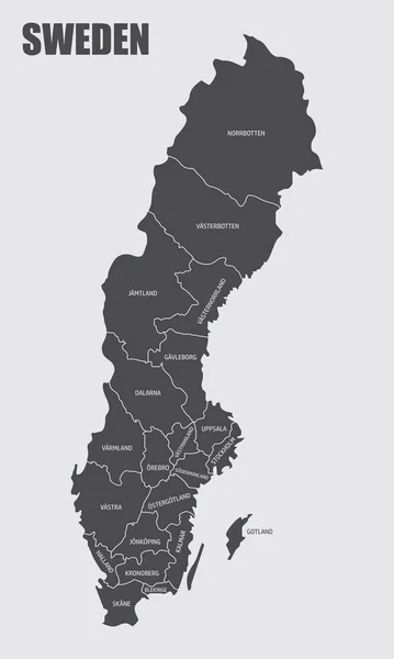
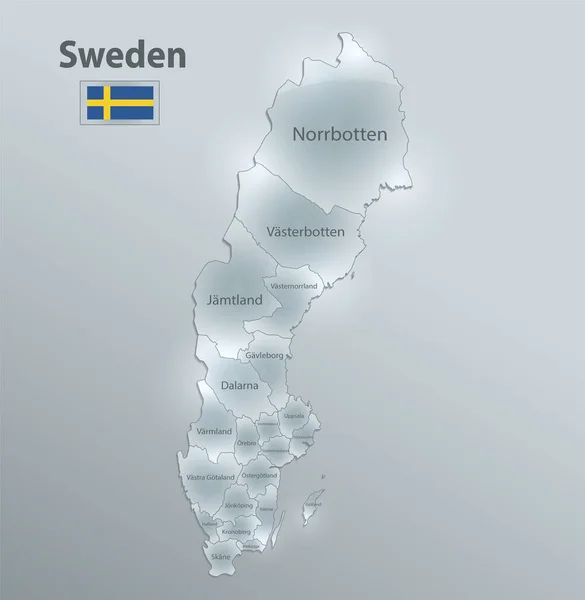
Stock vector The Sweden isolated map divided in counties with labels
Published:
Nov.25, 2020 13:27:52
Author:
luisrftc
Views:
4
Downloads:
0
File type:
vector
/
eps
File size:
8.51 MB
Orginal size:
3000
x
5000
px
Available sizes:
S
(300 x 500)
M
(600 x 1000)
L
(1200 x 2000)
XL
(3000 x 5000)
VECT
(3000 x 5000)
EL0
(3000 x 5000)
Level:
bronze
Download Vector
Vector topics:
White
Vector
Background
Graphic
Illustration
Design
Isolated
Shape
Travel
Silhouette
Border
Modern
Gray
Symbol
Concept
Icon
City
Flat
Contour
Grey
Simple
Stockholm
Sweden
Europe
Outline
Country
District
Map
Cartography
Geography
Area
National
Trip
State
Administrative
Region
Division
Territory
Swedish
Province
Nation
County
Regional
Provinces
Simplified
Halland
Kalmar
Uppsala
Norrbotten
Similar stock vectors
Map Of The Country Of Sweden
2674 × 3160
Sweden Map And Flag, Administrative Division, Separates Regions And Names Individual Region, Design Glass Card 3D Vector
4000 × 4096
Sweden Map On Transparent Background. Vector Illustration.
5000 × 3750
Outline Map Of Sweden. Vector Illustration.
5000 × 5000
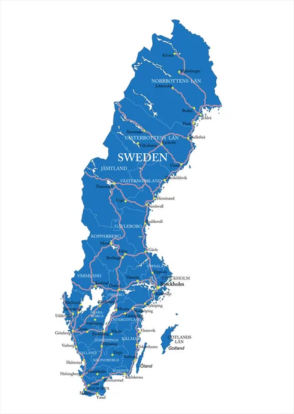
Sweden Map, Administrative Division With Names, Colors Map Isolated On White Background Vector
4000 × 4283
Country Shape Isolated On Background Of The Country Of Sweden
3472 × 3472
Highly Detailed Vector Map Of Sweden With Administrative Regions, Main Cities And Roads.
3565 × 5000
Vector Map Of Sweden | Outline Detailed Map With City Names
4494 × 9560