Home
Images
Vectors
Videos
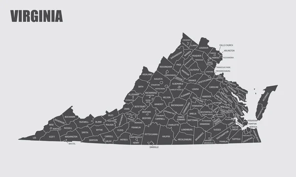
Stock vector The Virginia State map divided in counties with labels, USA
Published:
Sep.14, 2020 10:27:03
Author:
luisrftc
Views:
3
Downloads:
3
File type:
vector
/
eps
File size:
9.89 MB
Orginal size:
5000
x
3000
px
Available sizes:
S
(500 x 300)
M
(1000 x 600)
L
(2000 x 1200)
XL
(5000 x 3000)
VECT
(5000 x 3000)
EL0
(5000 x 3000)
Level:
bronze
Download Vector
Vector topics:
White
Vector
Background
Illustration
Design
Isolated
Shape
Travel
Nature
Leaf
Abstract
Transport
Vehicle
Transportation
Man
Black
Line
Silhouette
Gray
Symbol
City
House
Hospital
Home
Contour
Us
Usa
Tourism
North
South
Navigation
Map
Cartography
Icons
Geography
State
Location
America
United
Helpful
Use
States
Federal
Virginia
Labels
County
Names
Topographical
Counties
Similar stock vectors
Virginia. United States Of America. Vector Illustration. Watercolor Texture.
6250 × 6250
Sketch Map Of Virginia Grayscale Hand Drawn Map Of The Us State Filled Regions With Hachure
5944 × 5078
High Quality Map State Of United States
5714 × 4000
Virginia Map Vector Outline Design Template. Editable Stroke.
5000 × 5000
State Virginia Map On Transparent Background. Blank Map Of Virginia With Regions In Gray For Your Web Site Design, Logo, App, UI. USA. EPS10.
7500 × 3750
Vector Abstract Hatched Map Of State Of Virginia With Lines Isolated On A White Background.
5000 × 5000
Vector Abstract Hatched Map Of State Of Virginia Isolated On A White Background.
5000 × 5000
Virginia USA Map Black Inverted Silhouette
10433 × 5000