Home
Images
Vectors
Videos
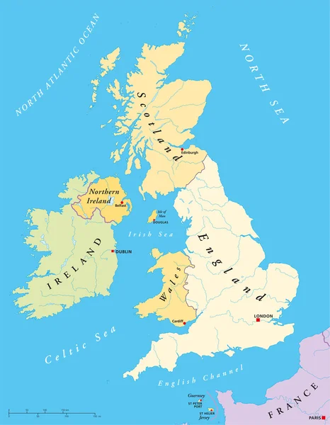
Stock vector United Kingdom Political Map
Published:
Jun.11, 2014 11:34:44
Author:
Furian
Views:
5098
Downloads:
41
File type:
vector
/
eps
File size:
3.35 MB
Orginal size:
6000
x
7715
px
Available sizes:
S
(389 x 500)
M
(778 x 1000)
L
(1555 x 2000)
XL
(6000 x 7715)
VECT
(6000 x 7715)
EL0
(6000 x 7715)
Level:
silver
Download Vector
Vector topics:
Vector
Europe
Map
Cartography
Ireland
Uk
Jersey
Of
United
Kingdom
Britain
London
Plymouth
York
England
Atlas
Wales
Scotland
Liverpool
Dublin
Thames
Manchester
Edinburgh
Guernsey
Cambridge
Dover
Nottingham
Glasgow
Bristol
Brighton
Douglas
Mapa
Birmingham
Belfast
Cardiff
Southampton
Great Britain
United Kingdom
North Sea
Northern Ireland
Isle Of Man
St Helier
Channel Islands
Wielka
Loch Ness
English Channel
Irish Sea
Celtic Sea
St Peter Port
British Islands
Similar stock vectors
British Isles Map
6000 × 7715
Northen Ireland
3274 × 3005
Saint Kitts And Nevis Road Vector Map
3100 × 3576
Mexico Political Map
8351 × 6000
Southeast Asia, Political Map With Capitals And Borders. Subregion Of Asia With Countries South Of China, East Of India, West Of New Guinea, North Of Australia. English Labeling. Illustration. Vector.
7292 × 8333
Senegal Political Map
7362 × 6000
Oman Political Map
6000 × 7534
Peoples Republic Of China, PRC, Political Map. Area Controlled By China In Yellow, And Claimed But Uncontrolled Regions Shown In Orange. Capitals And Borders. English Labeling. Illustration. Vector.
8033 × 8033