Home
Images
Vectors
Videos
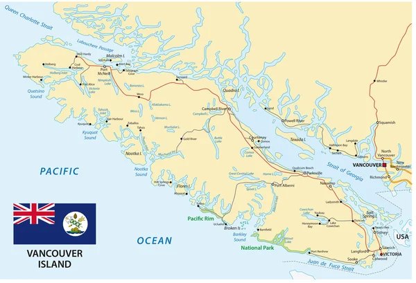
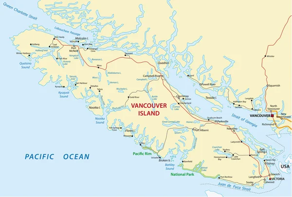
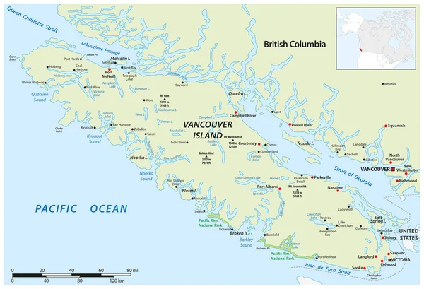
Stock vector Vector map of the Canadian Pacific island of Vancouver Island
Published:
May.01, 2023 14:54:07
Author:
Lesniewski
Views:
1
Downloads:
0
File type:
vector
/
eps
File size:
3.64 MB
Orginal size:
4542
x
3100
px
Available sizes:
S
(500 x 341)
M
(1000 x 683)
L
(2000 x 1365)
XL
(4542 x 3100)
VECT
(4542 x 3100)
EL0
(4542 x 3100)
Level:
bronze
Download Vector
Vector topics:
Color
Vector
Background
Graphic
Illustration
Design
Travel
Mountain
Silhouette
Border
River
City
Sound
Contour
Scale
Bay
Coastal
Coastline
Tourism
Peak
Outline
Hill
Country
Map
Cartography
Geography
Overview
Lake
State
Topography
America
Island
Political
Passage
Canada
Touristic
Destination
Cape
Region
Northwest
Mapping
Vancouver
Victoria
Infographic
National Park
Pacific Ocean
British Columbia
Vancouver Island
Similar stock vectors
Vector Map Of Canada Island Vancouver Island
4549 × 3100
Vancouver Iseland Map With Flag
4539 × 3100
Vancouver Iseland Map
4578 × 3100
Map Surrounding Olympic Peninsula And Greater Seattle, Washington, United States
3677 × 3100
Vector Road Map Of The Alaska Highway From Delta Junction To Dawson Creek, Canada, USA
3195 × 3100
Map Of The Alaska Marine Highway System, Ferry, United States
7589 × 3100
Washington State Map
8192 × 6235
Physical Map Of Washington State
8192 × 6235