Home
Images
Vectors
Videos
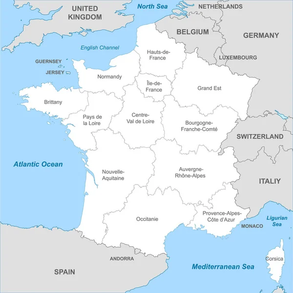
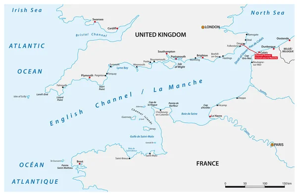
Stock vector Vector map of the English Channel between United Kingdom and France
Published:
Feb.02, 2022 11:54:37
Author:
Lesniewski
Views:
10
Downloads:
1
File type:
vector
/
eps
File size:
1.01 MB
Orginal size:
4683
x
3100
px
Available sizes:
S
(500 x 331)
M
(1000 x 662)
L
(2000 x 1324)
XL
(4683 x 3100)
VECT
(4683 x 3100)
EL0
(4683 x 3100)
Level:
bronze
Download Vector
Vector topics:
Vector
Travel
Sea
River
City
Scale
France
Bay
Coastline
Europe
Outline
Map
Cartography
Geography
Uk
Canal
Channel
Great
Island
Cape
Brest
Paris
Britain
London
English
England
Tunnel
Belgium
Atlas
Peninsula
Seine
Wight
County
Waterway
Cornwall
Somme
Southampton
Portsmouth
United Kingdom
North Sea
Atlantic Ocean
Saint Malo
Channel Islands
English Channel
Irish Sea
Cherbourg
Hydrographic
Le Havre
Strait Of Dover
Similar stock vectors
French Riviera, Political Map. Mediterranean Coastline Of The Southeast Corner Of France, Known As Cote DAzur (Azure Coast). Usually Considered To Extend From Toulon In The West To Menton In The East.
9000 × 6000
Bay Of Biscaya Vector Map, France, Spain.
3255 × 3100
Map Of Brittany
4739 × 3377
Map Of The French Southern And Antarctic Territories With Flag
3100 × 4561
Highly Detailed Vector Map Of Monaco With Administrative Regions,main Cities And Roads.
4026 × 5000
Map Of Brittany
4739 × 3377
Political Map Of France With Borders With Borders Of Regions And Countries
4000 × 4000
Vector Map Of The Two Mediterranean Sea Islands Of Corsica And Sardinia
3100 × 5317