Home
Images
Vectors
Videos
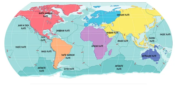
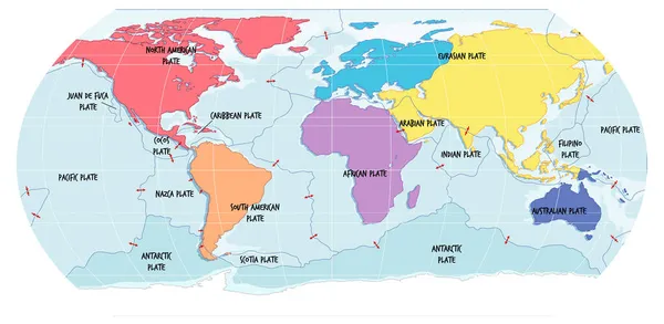
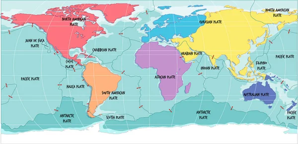
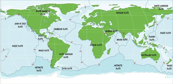
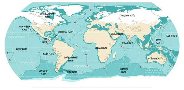
Stock vector World Map Showing Tectonic Plates Boundaries illustration
Published:
Jul.14, 2021 10:05:10
Author:
blueringmedia
Views:
105
Downloads:
2
File type:
vector
/
eps
File size:
2.05 MB
Orginal size:
6599
x
3367
px
Available sizes:
S
(500 x 255)
M
(1000 x 510)
L
(2000 x 1020)
XL
(6599 x 3367)
VECT
(6599 x 3367)
EL0
(6599 x 3367)
Level:
gold
Download Vector
Vector topics:
Vector
Background
Object
Illustration
Sign
Outdoor
Environment
Board
Plate
Dish
Border
Frame
Cartoon
African
Symbol
Icon
Blank
Text
Global
Drawing
Education
Earth
World
American
Science
Learn
North
Globe
South
Map
Geography
Outside
Pacific
Land
Worldwide
Scientific
Font
International
Alphabet
Diagram
Indian
Eps
Signage
Eurasian
Convergent
Labeled
Sciences
Tectonic
Indo Australian
Similar stock vectors
World Map Showing Tectonic Plates Boundaries Illustration
7071 × 3457
World Map Showing Tectonic Plates Boundaries Illustration
7071 × 3457
World Map Showing Tectonic Plates Boundaries Illustration
6769 × 3282
World Map Showing Tectonic Plates Boundaries Illustration
6765 × 3285
World Map Showing Tectonic Plates Boundaries Illustration
7084 × 3466
World Map With Continents Names And Oceans Illustration
6683 × 3325
The Ocean Current World Map With Names Illustration
7351 × 3295
Map Of Tectonic Plates And Boundaries Illustration
6698 × 3318