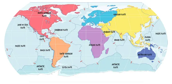
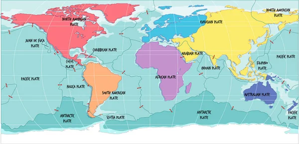
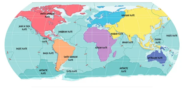
Stock vector World Map Showing Tectonic Plates Boundaries illustration
Published: Sep.08, 2021 10:10:24
Author: blueringmedia
Views: 30
Downloads: 2
File type: vector / eps
File size: 2.39 MB
Orginal size: 7071 x 3457 px
Available sizes:
Level: gold