photo free
Home Images Vectors Videos

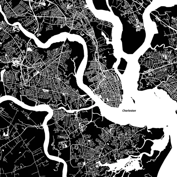
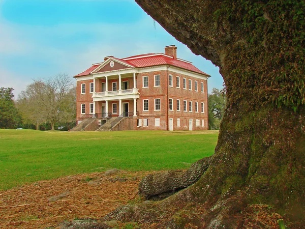
Stock image Charleston County

stock image The Ravenel Bridge, as seen from the water Charleston, SC

The Ravenel Bridge, As Seen From The Water Charleston, SC

Image, 12.02MB, 6016 × 4016 jpg
stock image Isle of Palms Pier at sunrise in Charleston, South Carolina

Isle Of Palms Pier At Sunrise In Charleston, South Carolina

Image, 15.1MB, 6000 × 4000 jpg
stock vector South Carolina Map

South Carolina Map

Vector, 9.09MB, 5000 × 4000 eps
stock vector West virginia map

West Virginia Map

Vector, 4.02MB, 5001 × 4930 eps
stock image Aerial of Historic Frederick, Maryland Near Carroll Creek Promena

Aerial Of Historic Frederick, Maryland Near Carroll Creek Promena

Image, 11.09MB, 6000 × 4000 jpg
stock vector South Carolina County Map

South Carolina County Map

Vector, 0.89MB, 5000 × 5000 ai
stock vector Detailed map of South Carolina state,in vector format,with county borders,roads and major cities.

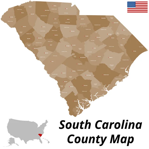
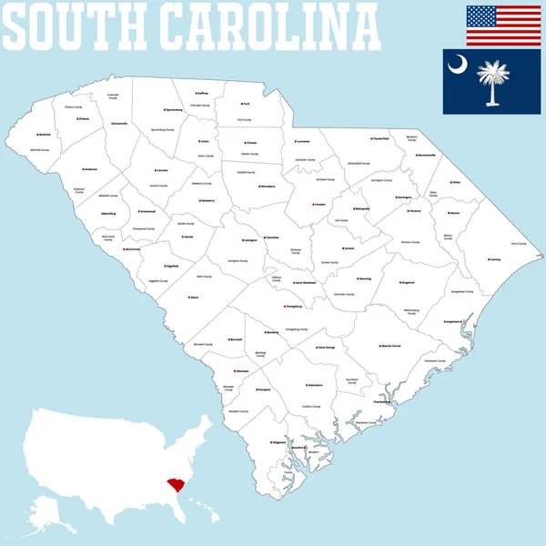
Detailed Map Of South Carolina State,in Vector Format,with County Borders,roads And Major Cities.

Vector, 2.91MB, 7498 × 6061 eps
stock vector South Carolina County Map

South Carolina County Map

Vector, 0.95MB, 5000 × 5000 ai
stock vector West Virginia map

West Virginia Map

Vector, 8.19MB, 7002 × 7002 eps
stock vector road map of the US American State of West Virginia

Road Map Of The US American State Of West Virginia

Vector, 1.4MB, 3933 × 3100 eps
stock image The County Courthouse in Charleston, South Carolina.

The County Courthouse In Charleston, South Carolina.

Image, 6.16MB, 3800 × 2533 jpg
stock vector Black highlighted location map of the Hancock County inside gray administrative map of the Federal State of West Virginia, USA

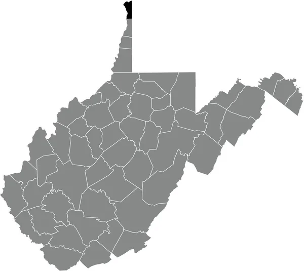
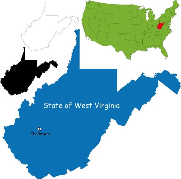
Black Highlighted Location Map Of The Hancock County Inside Gray Administrative Map Of The Federal State Of West Virginia, USA

Vector, 0.99MB, 5207 × 4647 eps
stock image The County Courthouse in Charleston, South Carolina.

The County Courthouse In Charleston, South Carolina.

Image, 6.17MB, 3800 × 2534 jpg
stock image Historic Downtown Charleston South Carolina on a Warm Day

Historic Downtown Charleston South Carolina On A Warm Day

Image, 16.73MB, 5992 × 3995 jpg
stock image Folly Beach on Folly Beach Island Charleston, South Carolina Dur

Folly Beach On Folly Beach Island Charleston, South Carolina Dur

Image, 10.36MB, 5671 × 3781 jpg
stock image Folly Beach on Folly Beach Island Charleston, South Carolina Dur

Folly Beach On Folly Beach Island Charleston, South Carolina Dur

Image, 11.57MB, 6000 × 4000 jpg
stock vector West Virginia counties vector map

West Virginia Counties Vector Map

Vector, 5.68MB, 4697 × 4039 eps
stock image Pier at Ise of Palms Beach, in Charleston South Carolina at Sunr

Pier At Ise Of Palms Beach, In Charleston South Carolina At Sunr

Image, 8.58MB, 5640 × 3760 jpg
stock vector West Virginia County Map

West Virginia County Map

Vector, 0.93MB, 5000 × 5000 ai
stock image Pier at Ise of Palms Beach, in Charleston South Carolina at Sunr

Pier At Ise Of Palms Beach, In Charleston South Carolina At Sunr

Image, 11.64MB, 6000 × 4000 jpg
stock image Isle of Palms Pier at sunrise in Charleston, South Carolina

Isle Of Palms Pier At Sunrise In Charleston, South Carolina

Image, 12.97MB, 6000 × 4000 jpg
stock image Water Front Park in Charleston South Carolina

Water Front Park In Charleston South Carolina

Image, 18.1MB, 6000 × 4000 jpg
stock image Isle of Palms Pier at sunrise in Charleston, South Carolina

Isle Of Palms Pier At Sunrise In Charleston, South Carolina

Image, 13.11MB, 6000 × 4000 jpg
stock image Isle of Palms Pier at sunrise in Charleston, South Carolina

Isle Of Palms Pier At Sunrise In Charleston, South Carolina

Image, 13.93MB, 6000 × 4000 jpg
stock image Skyline of beach homes at Isle of Palms, in Charleston South Car

Skyline Of Beach Homes At Isle Of Palms, In Charleston South Car

Image, 13.72MB, 6000 × 4000 jpg
stock vector blue abstract outline of West Virginia map

Blue Abstract Outline Of West Virginia Map

Vector, 1.57MB, 4000 × 4000 eps
stock image Landscape of the Sunrise with it reflecting in the ocean on Foll

Landscape Of The Sunrise With It Reflecting In The Ocean On Foll

Image, 12.39MB, 6000 × 4000 jpg
stock image Landscape of the Sunrise with it reflecting in the ocean on Foll

Landscape Of The Sunrise With It Reflecting In The Ocean On Foll

Image, 12.39MB, 6000 × 4000 jpg
stock image Skyline of Beach Homes at Ise of Palms Beach, in Charleston Sout

Skyline Of Beach Homes At Ise Of Palms Beach, In Charleston Sout

Image, 11.39MB, 6000 × 4000 jpg
stock vector Map of West Virginia

Map Of West Virginia

Vector, 0.9MB, 5002 × 5000 ai
stock image Isle of Palms Pier at sunrise in Charleston, South Carolina

Isle Of Palms Pier At Sunrise In Charleston, South Carolina

Image, 13.45MB, 6000 × 4000 jpg
stock image Historic Downtown Charleston South Carolina on a Warm Day

Historic Downtown Charleston South Carolina On A Warm Day

Image, 17.89MB, 5938 × 3979 jpg
stock image Water Front Park in Charleston South Carolina

Water Front Park In Charleston South Carolina

Image, 10.37MB, 5979 × 3993 jpg
stock image Skyline of Beach Homes at Ise of Palms Beach, in Charleston Sout

Skyline Of Beach Homes At Ise Of Palms Beach, In Charleston Sout

Image, 13.21MB, 6000 × 4000 jpg
stock vector Vector set 7 of 10 Highly detailed silhouettes of US state maps, divided into counties with names and territory nicknames

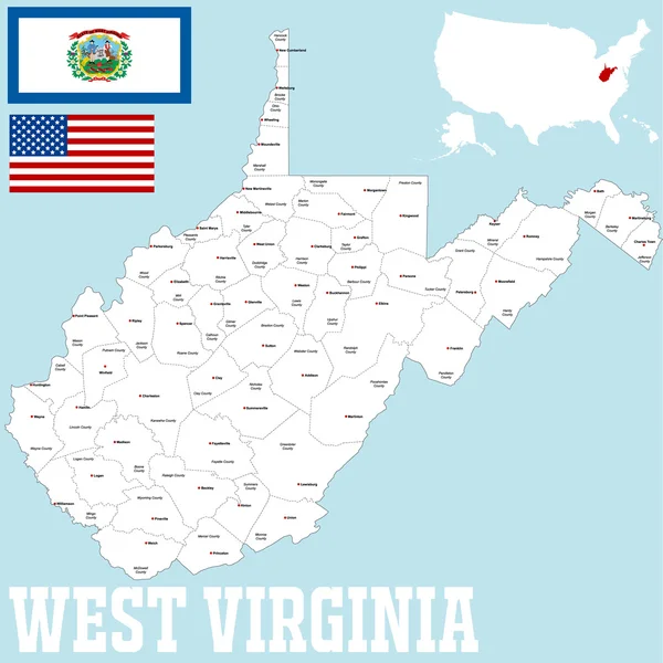
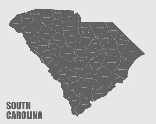
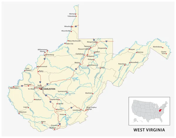
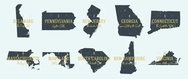
Vector Set 7 Of 10 Highly Detailed Silhouettes Of US State Maps, Divided Into Counties With Names And Territory Nicknames

Vector, 5.89MB, 9585 × 3348 eps
stock vector Vector set 2 of 10 Highly detailed silhouettes of US state maps, divided into counties with names and territory nicknames

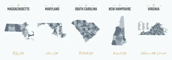
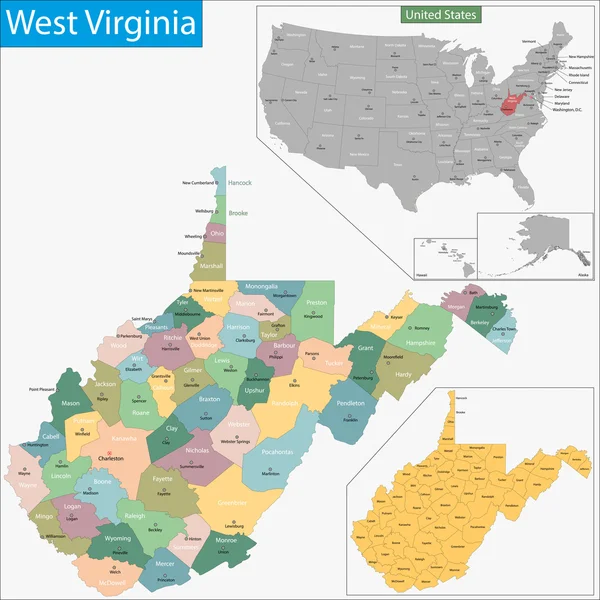
Vector Set 2 Of 10 Highly Detailed Silhouettes Of US State Maps, Divided Into Counties With Names And Territory Nicknames

Vector, 5.14MB, 9585 × 3348 eps
stock image Berkeley County Courthouse in Martinsburg, West Virginia

Berkeley County Courthouse In Martinsburg, West Virginia

Image, 12.37MB, 4000 × 6000 jpg
stock vector Black map of West Virginia

Black Map Of West Virginia

Vector, 1.56MB, 4000 × 4000 eps
stock image Historic Downtown Charleston South Carolina on a Warm Day

Historic Downtown Charleston South Carolina On A Warm Day

Image, 20.11MB, 6000 × 4000 jpg
stock image Putting Green

Putting Green

Image, 18.31MB, 5775 × 3840 jpg
stock vector Charleston Vector Map

Charleston Vector Map

Vector, 2.55MB, 8000 × 8000 eps
stock image Swamp in Cypress Gardens. A Swamp Forest and Its Calm Reflection. Bald cypress swamp tree forest in Cypress Gardens, Moncks Corner, Charleston, SC. Closeup of cypress trunk and buttress in a peaceful swampland

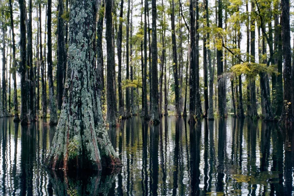
Swamp In Cypress Gardens. A Swamp Forest And Its Calm Reflection. Bald Cypress Swamp Tree Forest In Cypress Gardens, Moncks Corner, Charleston, SC. Closeup Of Cypress Trunk And Buttress In A Peaceful Swampland

Image, 41.83MB, 6975 × 4650 jpg
stock vector black outline of West Virginia map - vector illustration

Black Outline Of West Virginia Map - Vector Illustration

Vector, 7.3MB, 4000 × 4000 eps
stock image architecture bridge

Architecture Bridge

Image, 20.89MB, 7240 × 5433 jpg
stock image Charleston Falls and Sycamore Tree

Charleston Falls And Sycamore Tree

Image, 16.16MB, 3786 × 5661 jpg
stock vector Highly detailed vector silhouettes of US state maps, Division United States into counties, political and geographic subdivisions of a states, South Atlantic - South Carolina, North Carolina, Delaware - set 9 of 17

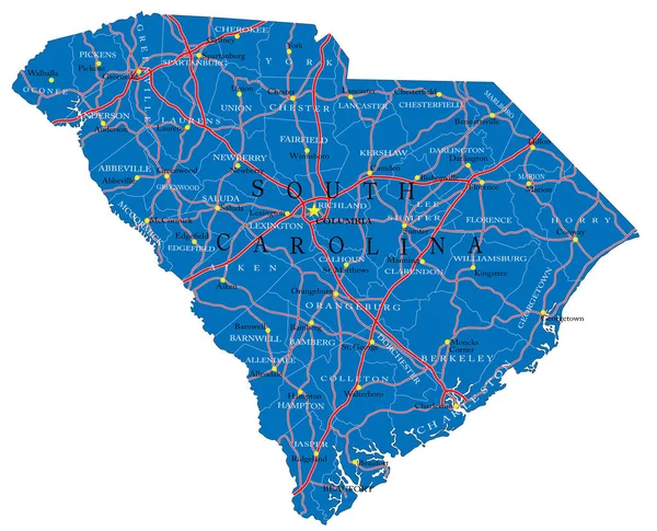
Highly Detailed Vector Silhouettes Of US State Maps, Division United States Into Counties, Political And Geographic Subdivisions Of A States, South Atlantic - South Carolina, North Carolina, Delaware - Set 9 Of 17

Vector, 9.36MB, 9608 × 4501 eps
stock image Drayton Hall, South Carolina

Drayton Hall, South Carolina

Image, 7.88MB, 3072 × 2304 jpg
stock image Drayton Hall, South Carolina

Drayton Hall, South Carolina

Image, 7.37MB, 3072 × 2304 jpg
stock vector South carolina map shape, united states of america. Flat concept icon symbol vector illustration .

South Carolina Map Shape, United States Of America. Flat Concept Icon Symbol Vector Illustration .

Vector, 0.53MB, 4096 × 4096 eps
stock vector Set 1 of 5 Highly detailed vector silhouettes of USA state maps

Set 1 Of 5 Highly Detailed Vector Silhouettes Of USA State Maps

Vector, 4.79MB, 8858 × 3738 eps
Page 1 >> Next