
Stock image Greene Silhouette Map

Map Of Greene County In Illinois State On White Background. Single County Map Highlighted By Black Colour On Illinois Map. UNITED STATES, US
Image, 5.19MB, 8000 × 8000 jpg

Map Of Greene County In Georgia State On White Background. Single County Map Highlighted By Black Colour On Georgia Map. UNITED STATES, US
Image, 6.56MB, 8000 × 8000 jpg

Map Of Greene County In North Carolina State On White Background. Single County Map Highlighted By Black Color On North Carolina Map. UNITED STATES, US
Image, 4.32MB, 8000 × 5334 jpg

Map Of Greene County In Virginia State On White Background. Single County Map Highlighted By Black Colour On Virginia Map. UNITED STATES, US
Image, 4.45MB, 8000 × 5334 jpg
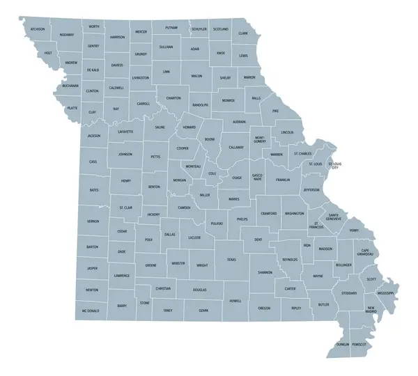
Missouri, Subdivided Into 114 Counties And The Independent City St. Louis, Gray Political Map. State In The Midwestern Region Of United States, Show Me State, Cave State, And Mother Of The West.
Vector, 3.09MB, 6656 × 6000 eps

Map Of Greene County In Ohio State On White Background. Single County Map Highlighted By Black Colour On Ohio Map. UNITED STATES, US
Image, 5.59MB, 8000 × 8000 jpg

Map Of Greene County In Pennsylvania State On White Background. Single County Map Highlighted By Black Colour On Pennsylvania Map. UNITED STATES, US
Image, 4.23MB, 8000 × 5334 jpg
Page 1 >> Next